Dan Thomas(@DanThomasWSMV) 's Twitter Profileg
Dan Thomas

@DanThomasWSMV

WSMV News4’s self proclaimed weather geek...and proud of it! Husband, father, work-out addict, palm tree freak, & major Penn State/Boston sports fan.

ID:233772363

linkhttp://www.wsmv.com calendar_today04-01-2011 02:22:09

21,2K Tweets

9,0K Followers

945 Following

Dan Thomas(@DanThomasWSMV) 's Twitter Profile Photo

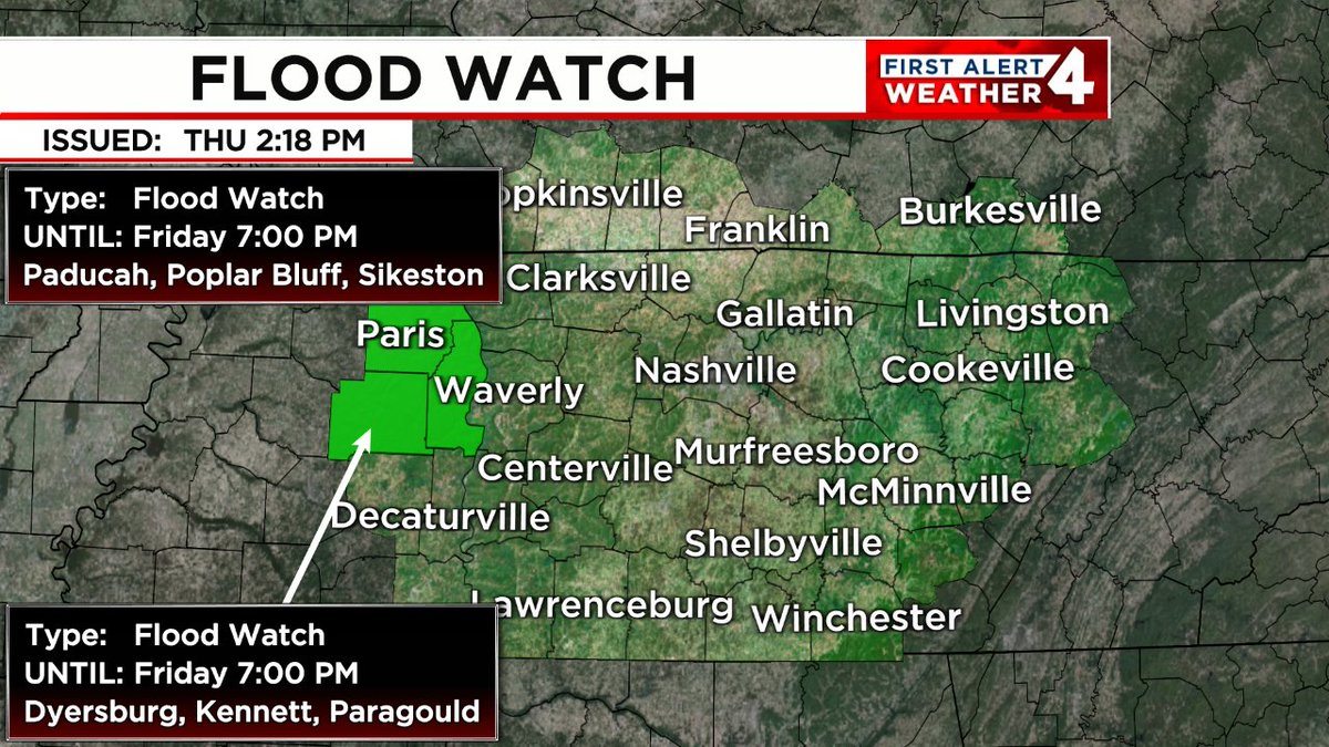
FLOOD WATCH/FLASH FLOOD WATCH: A Flood Watch/Flash Flood Watch has been issued for the highlighted area. If you're in that zone, monitor the Weather app closely for the duration of this watch, in case warnings are issued.

FLOOD WATCH/FLASH FLOOD WATCH: A Flood Watch/Flash Flood Watch has been issued for the highlighted area. If you're in that zone, monitor the #FirstAlert Weather app closely for the duration of this watch, in case warnings are issued.
account_circle
Dan Thomas(@DanThomasWSMV) 's Twitter Profile Photo

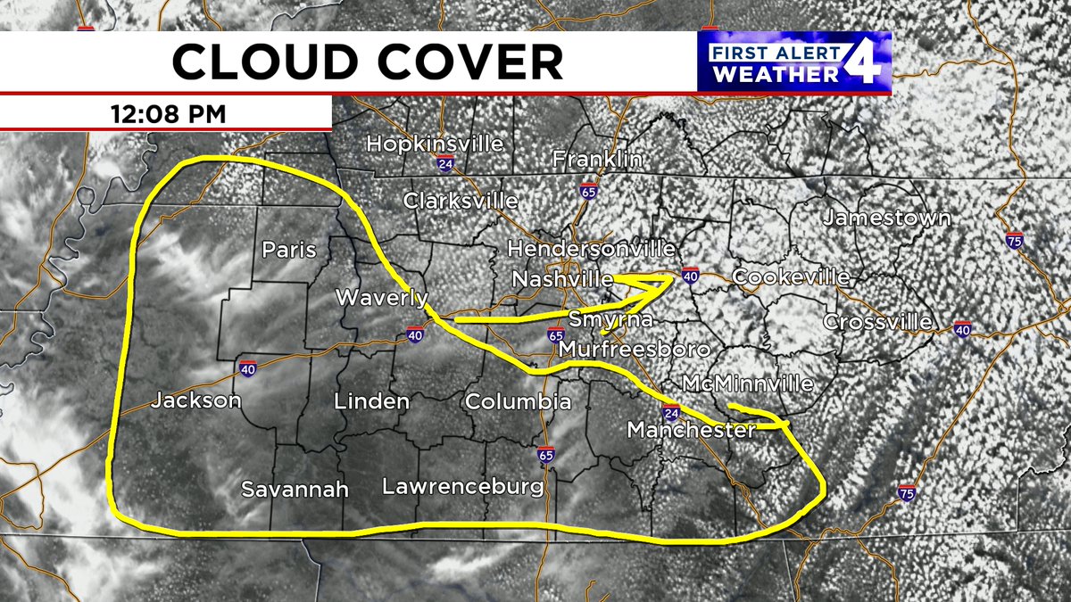
Sunnier weather will continue to overspread & the rest of the Mid State this afternoon. At last!

With that, temperatures will jump into the low 80s. No rain though...
@wsmv @wsmvweather WSMV 4 Nashville

Sunnier weather will continue to overspread #Nashville & the rest of the Mid State this afternoon. At last! With that, temperatures will jump into the low 80s. No rain though... @wsmv @wsmvweather #FirstAlert @WSMV #tnwx #kywx
account_circle
Dan Thomas(@DanThomasWSMV) 's Twitter Profile Photo

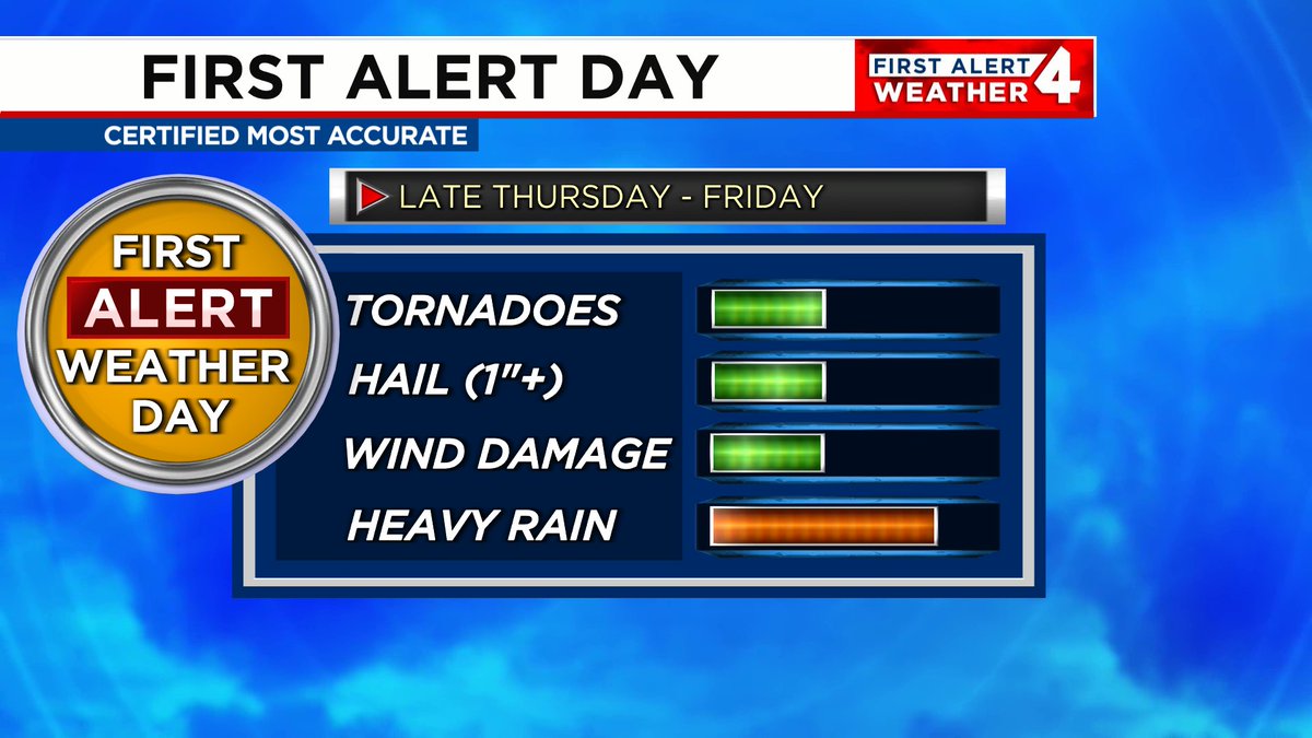
Late Thursday through Friday, showers & thunderstorms will return to parts of Middle Tennessee and southern Kentucky.

Damaging wind gusts & heavy downpours will be the main threats with any strong storms that develop.

WSMV 4 Nashville

Late Thursday through Friday, showers & thunderstorms will return to parts of Middle Tennessee and southern Kentucky. Damaging wind gusts & heavy downpours will be the main threats with any strong storms that develop. #FirstAlert @WSMV #tnwx #kywx
account_circle
Dan Thomas(@DanThomasWSMV) 's Twitter Profile Photo

12 tornadoes touched down in the Mid State from Monday - Thursday of last week.

A quick spin-up tornado also touched down yesterday in Lawrence County, around , bringing our 2024 total to 13.

We've already surpassed the annual average of 10!

First Alert WSMV 4 Nashville
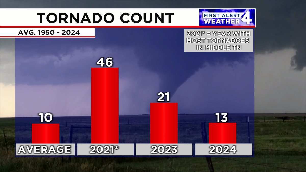
12 tornadoes touched down in the Mid State from Monday - Thursday of last week. A quick spin-up tornado also touched down yesterday in Lawrence County, around #Ethridge, bringing our 2024 total to 13. We've already surpassed the annual average of 10! @FirstAlert @WSMV
account_circle
Dan Thomas(@DanThomasWSMV) 's Twitter Profile Photo

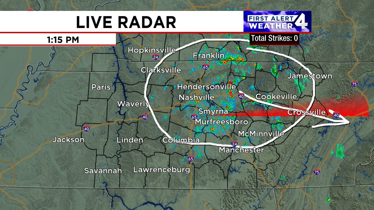
Rain showers continue to slide through the Mid State. They'll end by late afternoon in & early this evening along the Cumberland Plateau.
@wsmv @wsmvweather WSMV 4 Nashville

Rain showers continue to slide through the Mid State. They'll end by late afternoon in #Nashville & early this evening along the Cumberland Plateau. @wsmv @wsmvweather #FirstAlert @WSMV #tnwx #kywx
account_circle
Dan Thomas(@DanThomasWSMV) 's Twitter Profile Photo

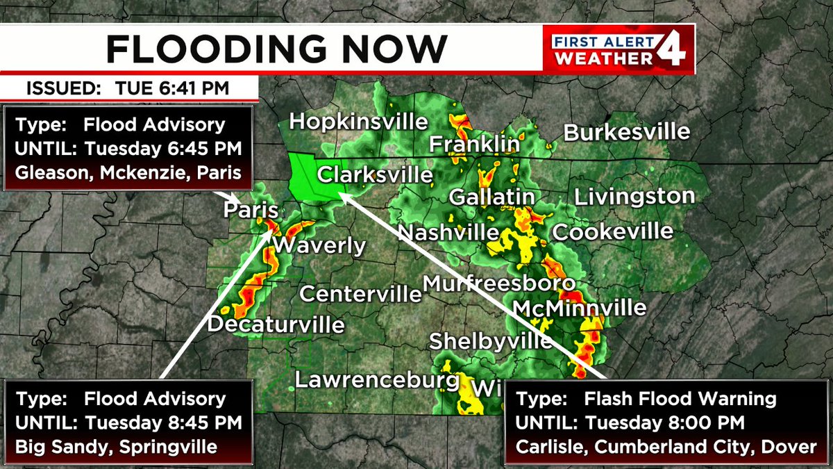
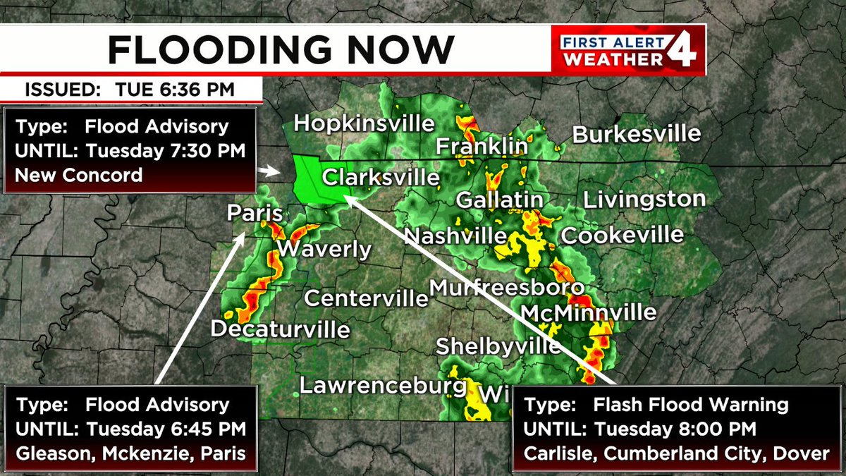
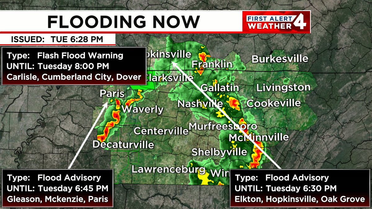
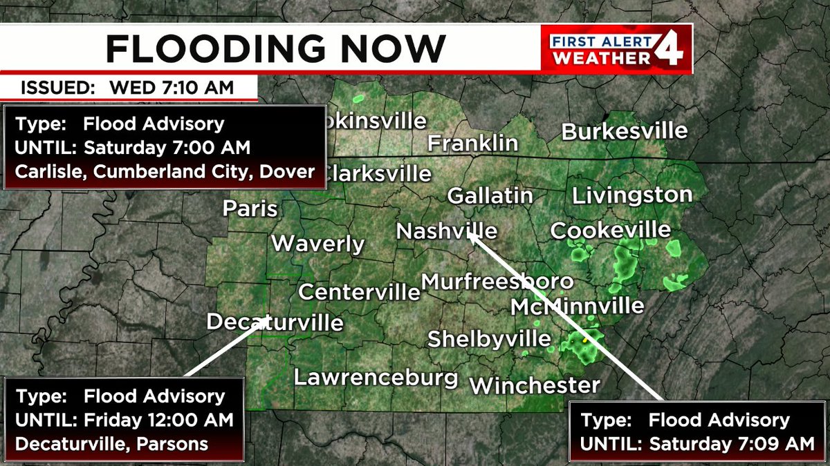
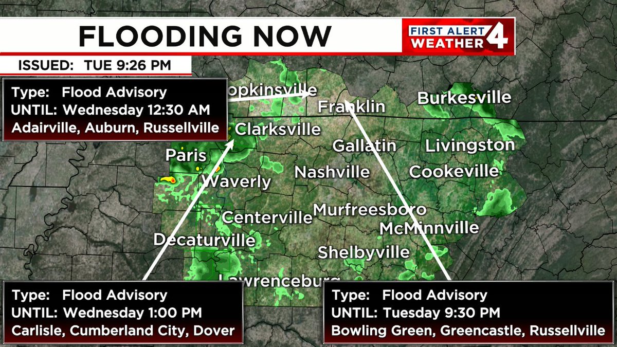
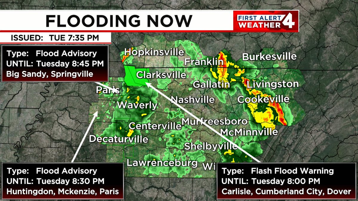
FLOODING IS OCCURRING. Turn around, don't drown! In the event of rising water, seek higher ground immediately. Tune to WSMV4 for the latest on this dangerous situation.

FLOODING IS OCCURRING. Turn around, don't drown! In the event of rising water, seek higher ground immediately. Tune to WSMV4 for the latest on this dangerous situation. #FirstAlert
account_circle
Dan Thomas(@DanThomasWSMV) 's Twitter Profile Photo

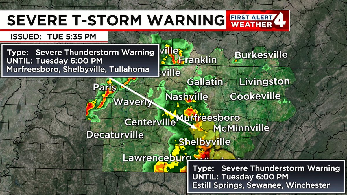
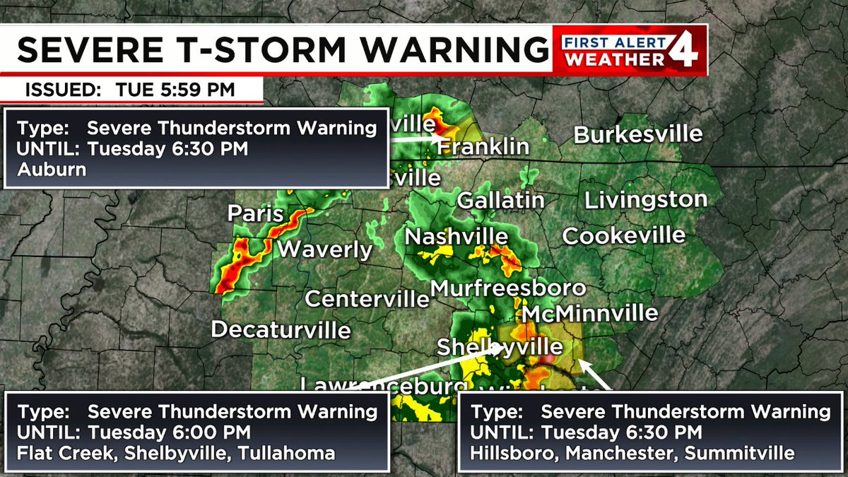
SEVERE THUNDERSTORM WARNING: 60mph+ wind gusts and/or 1' diameter hail or larger are possible in the highlighted area. Remain indoors & away from windows until this storm passes. Tune to WSMV NEWS4 for the latest on this dangerous storm.

SEVERE THUNDERSTORM WARNING: 60mph+ wind gusts and/or 1' diameter hail or larger are possible in the highlighted area. Remain indoors & away from windows until this storm passes. Tune to WSMV NEWS4 for the latest on this dangerous storm. #FirstAlert
account_circle