NWS Boulder(@NWSBoulder) 's Twitter Profileg
NWS Boulder

@NWSBoulder

Official Twitter account for the National Weather Service Denver/Boulder forecast office. Details: https://t.co/A4aVgbxmgI

ID:598443842

linkhttp://www.weather.gov/bou calendar_today03-06-2012 16:06:06

40,1K Tweets

100,4K Followers

236 Following

NWS Boulder(@NWSBoulder) 's Twitter Profile Photo

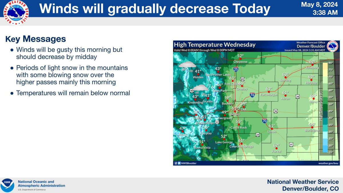
Winds will be gusty this morning but should gradually decrease by midday in most areas. Areas of light snow will continue in the mountains with some blowing snow over the higher passes.

Winds will be gusty this morning but should gradually decrease by midday in most areas. Areas of light snow will continue in the mountains with some blowing snow over the higher passes. #cowx
account_circle
NWS Boulder(@NWSBoulder) 's Twitter Profile Photo

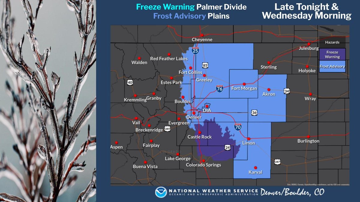
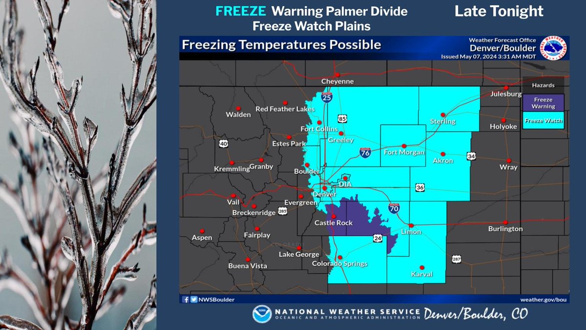
A Frost Advisory has been issued for the Urban Corridor and most of the eastern plains for late tonight and Wednesday morning. Also, a freeze warning is in effect for the Palmer Divide. Protect frost and cold sensitive plants from the sub freezing temperatures tonight.

A Frost Advisory has been issued for the Urban Corridor and most of the eastern plains for late tonight and Wednesday morning. Also, a freeze warning is in effect for the Palmer Divide. Protect frost and cold sensitive plants from the sub freezing temperatures tonight. #cowx
account_circle
NWS Boulder(@NWSBoulder) 's Twitter Profile Photo

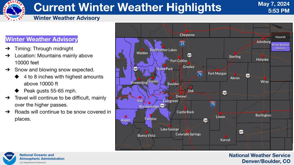
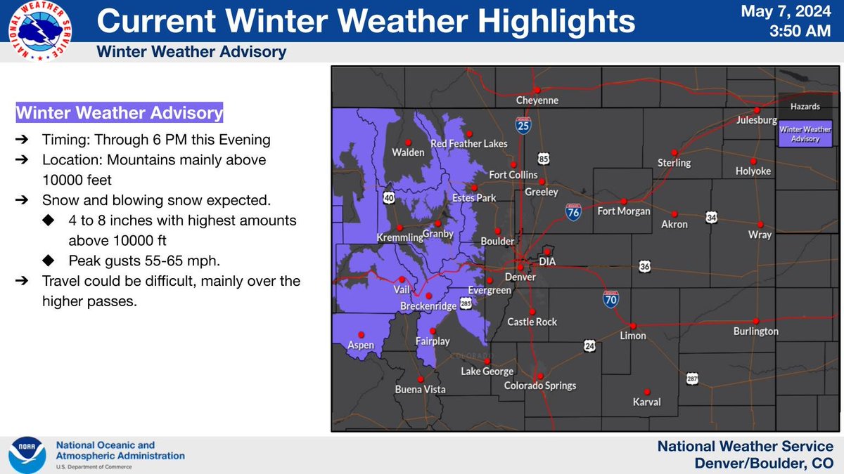
Winter Weather Advisory extended until midnight. Snow will continue over the mountains this evening. The snow combined with windy conditions will continue to produce snow covered roads and blowing snow leading to difficult travel at times.

Winter Weather Advisory extended until midnight. Snow will continue over the mountains this evening. The snow combined with windy conditions will continue to produce snow covered roads and blowing snow leading to difficult travel at times. #cowx
account_circle
NWS Boulder(@NWSBoulder) 's Twitter Profile Photo

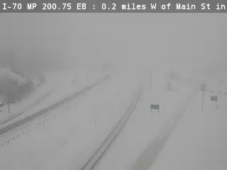
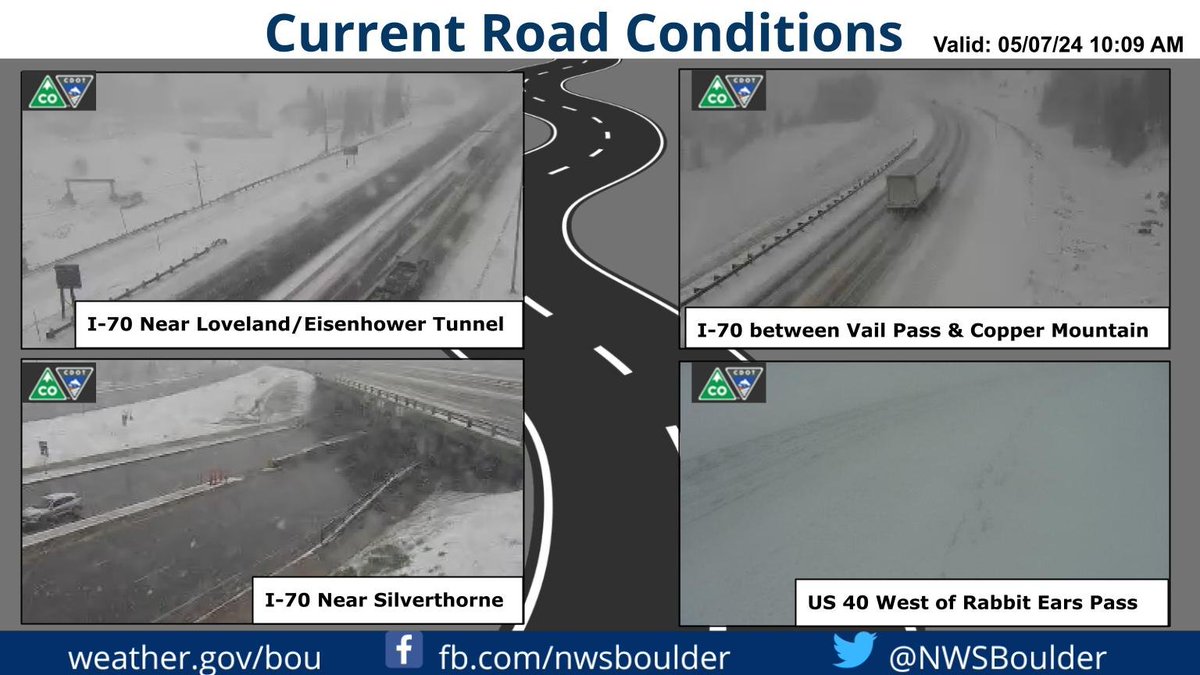
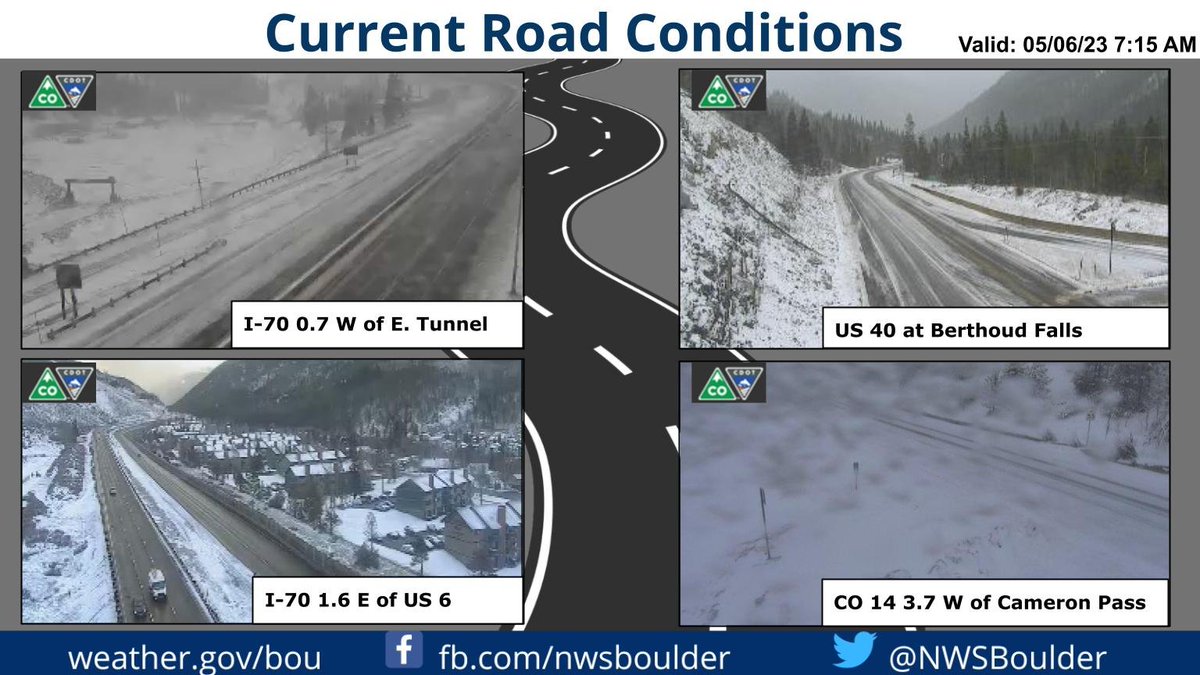
Snow is accumulating on the roads under the heavier snow showers in the mountains. CDOT webcams cotrip.org/home show travel is slow going and in some cases roads are temporarily closed. Image below is of I-70 near Frisco.

Snow is accumulating on the roads under the heavier snow showers in the mountains. CDOT webcams cotrip.org/home show travel is slow going and in some cases roads are temporarily closed. Image below is of I-70 near Frisco. #cowx
account_circle
NWS Boulder(@NWSBoulder) 's Twitter Profile Photo

❄️Still Winter in the Mountains!❄️

Welcome to Colorado. If you have travel plans through the Colorado high country be prepared for winter travel conditions through early this evening. A current look at cams and travel conditions via cotrip.org.

❄️Still Winter in the Mountains!❄️ Welcome to Colorado. If you have travel plans through the Colorado high country be prepared for winter travel conditions through early this evening. A current look at cams and travel conditions via cotrip.org. #COwx
account_circle
Denver Office of Emergency Management(@DenverOEM) 's Twitter Profile Photo

Tomorrow, May 8th, at 11 a.m. the city will be conducting a live outdoors siren test! This test is to ensure alert and warning systems within the city are fully functioning. No action is required for this test!

Tomorrow, May 8th, at 11 a.m. the city will be conducting a live outdoors siren test! This test is to ensure alert and warning systems within the city are fully functioning. No action is required for this test! #DenverListo #DenverReady #Sirentest2024 #JustATest
account_circle
NWS Boulder(@NWSBoulder) 's Twitter Profile Photo

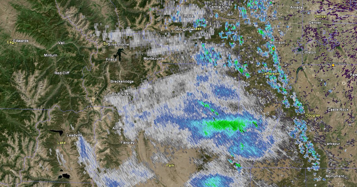
Main band of snow now stretches across northern Park County, impacting Highway 285 between Fairplay and Bailey. Pic from near Jefferson.

Snow showers become more widespread in the northern CO mountains later this morning.

Main band of snow now stretches across northern Park County, impacting Highway 285 between Fairplay and Bailey. Pic from near Jefferson. Snow showers become more widespread in the northern CO mountains later this morning. #COwx
account_circle
NWS Boulder(@NWSBoulder) 's Twitter Profile Photo

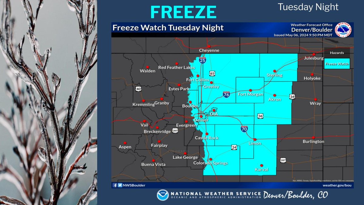
A freeze warning is in effect for Tuesday night and Wednesday morning for the Palmer Divide and a freeze watch remains in effect for the Plains. Protect sensitive plants from the sub freezing temperatures that are expected.

A freeze warning is in effect for Tuesday night and Wednesday morning for the Palmer Divide and a freeze watch remains in effect for the Plains. Protect sensitive plants from the sub freezing temperatures that are expected. #cowx
account_circle
NWS Boulder(@NWSBoulder) 's Twitter Profile Photo

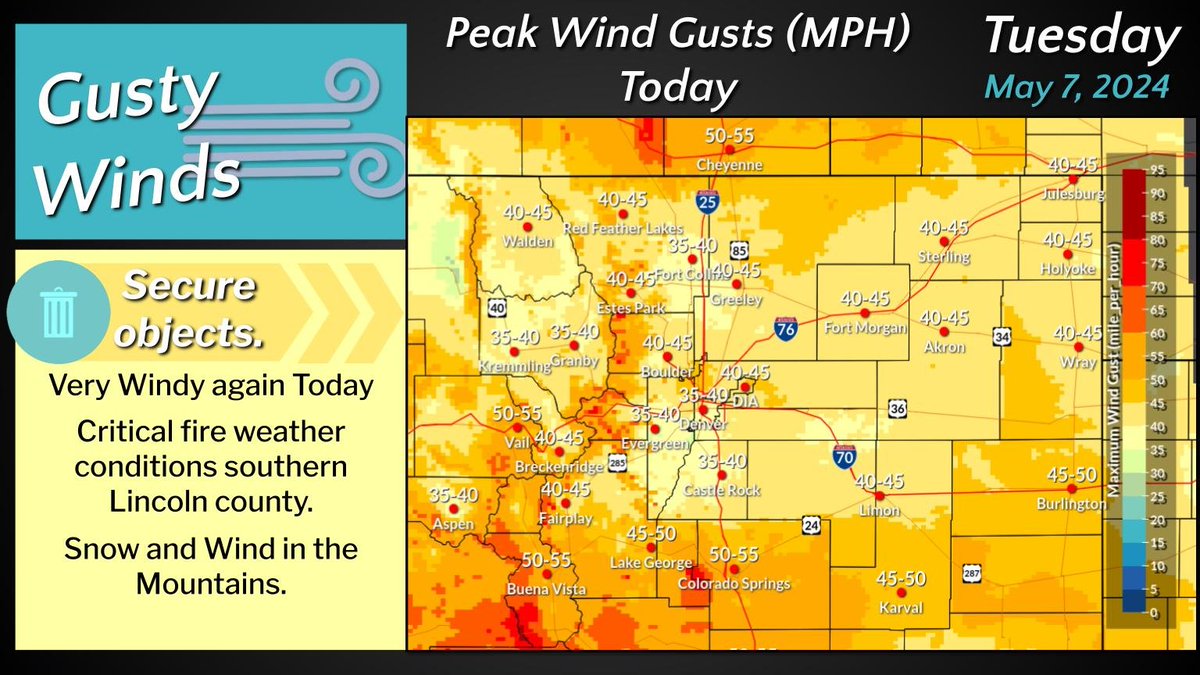
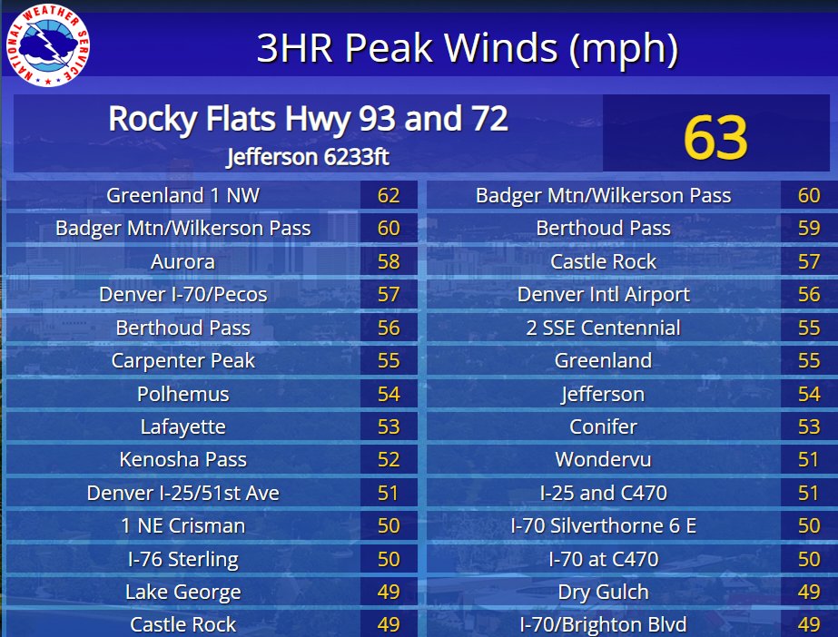
Windy conditions will continue today but not as strong as Monday. Wind gusts from 50 to 65 mph will occurs in the mountains and foothills with 40 to 50 mph across the plains.

Windy conditions will continue today but not as strong as Monday. Wind gusts from 50 to 65 mph will occurs in the mountains and foothills with 40 to 50 mph across the plains. #cowx
account_circle
NWS Boulder(@NWSBoulder) 's Twitter Profile Photo

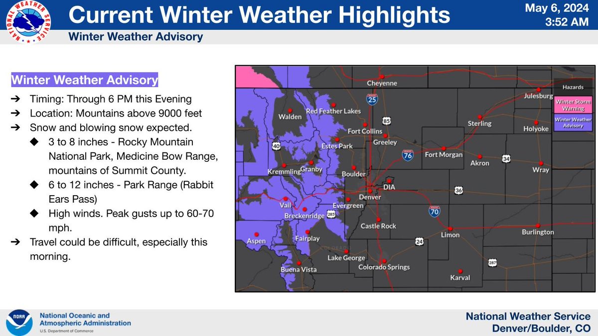
Snow will continue across the Mountains today. The snow combined with windy conditions will lead to areas of blowing snow and difficult travel at times, over the higher passes.

Snow will continue across the Mountains today. The snow combined with windy conditions will lead to areas of blowing snow and difficult travel at times, over the higher passes. #cowx
account_circle
NWS Boulder(@NWSBoulder) 's Twitter Profile Photo

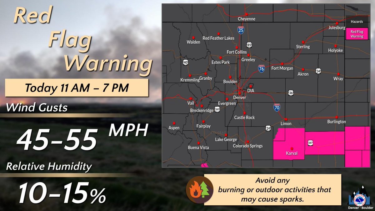
Critical fire conditions will be in place this afternoon into the early evening across southern Lincoln county. Wind gusts from 45-55 mph are expected along with low humidity.

Critical fire conditions will be in place this afternoon into the early evening across southern Lincoln county. Wind gusts from 45-55 mph are expected along with low humidity. #cowx
account_circle
NWS Boulder(@NWSBoulder) 's Twitter Profile Photo

A freeze watch is in effect for Tuesday night and Wednesday morning. Protect sensitive plants from the sub freezing temperatures that are expected.

A freeze watch is in effect for Tuesday night and Wednesday morning. Protect sensitive plants from the sub freezing temperatures that are expected. #cowx
account_circle
NWS Boulder(@NWSBoulder) 's Twitter Profile Photo

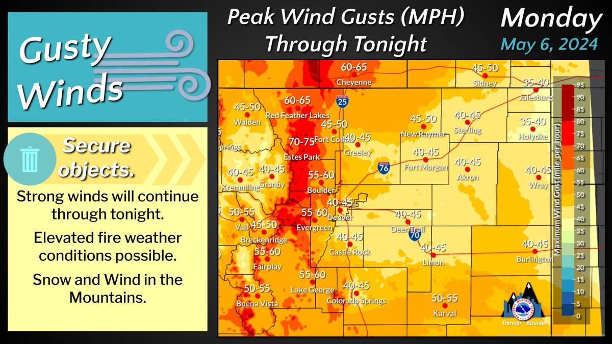
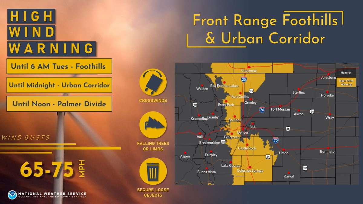
Strong winds to continue through this evening in and near the foothills where wind gusts from 65 to 85 mph will occur. Winds slowly decrease overnight though high winds to 75 mph will remain possible in the foothill after midnight.

Strong winds to continue through this evening in and near the foothills where wind gusts from 65 to 85 mph will occur. Winds slowly decrease overnight though high winds to 75 mph will remain possible in the foothill after midnight. #cowx
account_circle
NWS Boulder(@NWSBoulder) 's Twitter Profile Photo

Great question! Winds typically help eradicate ozone concentrations, but in high wind events like this with a deep upper level trough, we can get stratospheric intrusion of ozone (the same good ozone that protects us from UV, but can cause respiratory issues for some). twitter.com/Shelley_Cook/s…
account_circle
NWS Boulder(@NWSBoulder) 's Twitter Profile Photo

More snow accumulation expected through this afternoon. Slick spots and some snow covered roads are expected across the mountain passes and higher terrain roadways.

More snow accumulation expected through this afternoon. Slick spots and some snow covered roads are expected across the mountain passes and higher terrain roadways. #cowx #colorado
account_circle
NWS Boulder(@NWSBoulder) 's Twitter Profile Photo

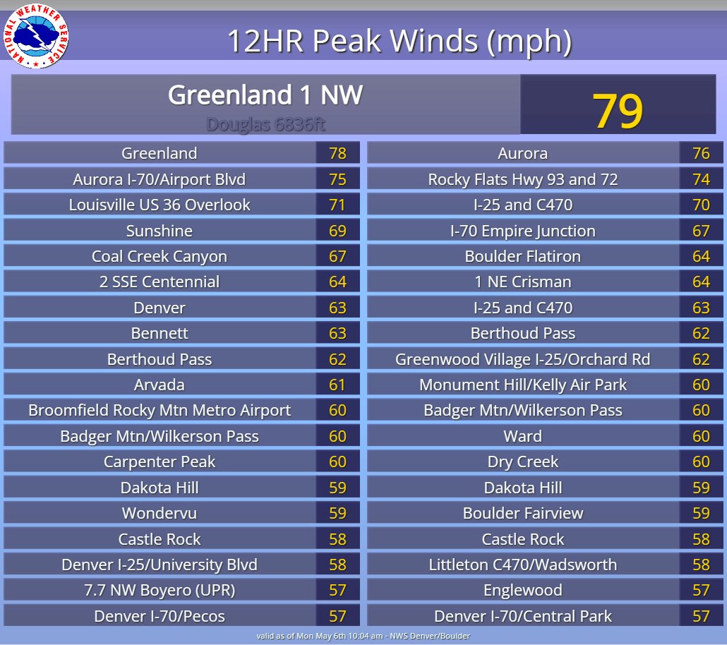
⚠️Blast of very strong/damaging winds ripping through parts of southeast Denver metro, too!

Recent gusts to 75 mph at Centennial Airport - spreading east through parts of Aurora.

Stay aware of your surroundings! Down tree limbs and powerlines possible.

account_circle
NWS Boulder(@NWSBoulder) 's Twitter Profile Photo

The High Wind Warning has been expanded to include the Palmer Divide area this morning. Strong winds occurring with gusts from 65 to 75 mph.

⚠️Avoid travel in high profile or lightweight vehicles
👀Be alert for falling signs/tree limbs.

The High Wind Warning has been expanded to include the Palmer Divide area this morning. Strong winds occurring with gusts from 65 to 75 mph. ⚠️Avoid travel in high profile or lightweight vehicles 👀Be alert for falling signs/tree limbs. #COwx
account_circle
NWS Boulder(@NWSBoulder) 's Twitter Profile Photo

Snow will continue across the Northern Mountains today. The snow combined with windy conditions will lead to areas of blowing snow and difficult travel at times, especially this morning.

Snow will continue across the Northern Mountains today. The snow combined with windy conditions will lead to areas of blowing snow and difficult travel at times, especially this morning. #cowx
account_circle