
Tamara Suju(@TAMARA_SUJU) 's Twitter Profile Photo

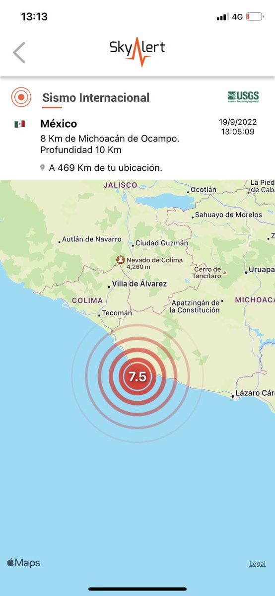
Venezuela despierta hoy, bajo un Milagro de Dios. El Terremoto de 7.3 grados pudo haber sido devastador Su profundidad fue de 123 km según la USGS, lo que evitó q en una Venezuela tan vulnerable en su estructura, ocurriera una gran catástrofe y un posible Tsunami.

account_circle
Mount St. Helens in 1980(@StHelensIn1980) 's Twitter Profile Photo

May 16, 1980 🧵

Penn State geologist Barry Voight — brother of actor Jon — has sketched an eruption scenario in a report that lands today in Vancouver.

An expert on landslides, Voight was asked in April by
USGS’s Rocky Crandall to provide analysis on the north face bulge.

account_circle
Somos Cosmos(@InformaCosmos) 's Twitter Profile Photo

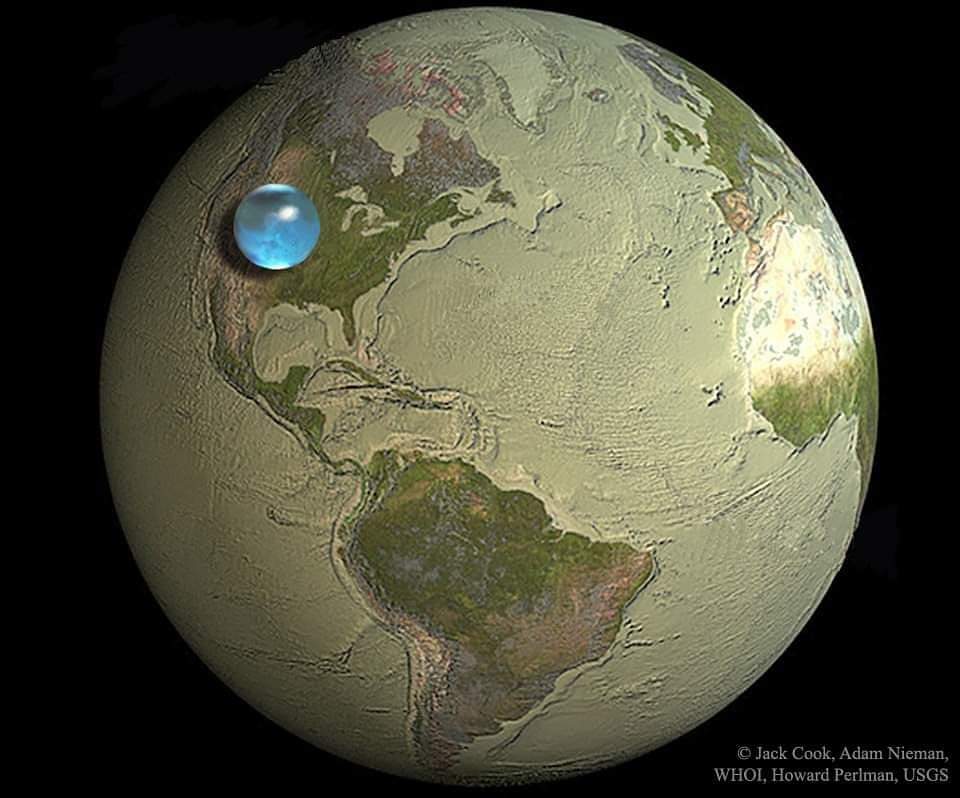
Esta 'pequeña' esfera celeste representa absolutamente toda el agua que existe en nuestro planeta. El agua de los océanos, lagos, ríos, subterránea y hasta de la atmósfera y los casquetes polares.

📷: Jack Cook/USGS

Esta 'pequeña' esfera celeste representa absolutamente toda el agua que existe en nuestro planeta. El agua de los océanos, lagos, ríos, subterránea y hasta de la atmósfera y los casquetes polares.

📷: Jack Cook/USGS
account_circle
USGS Volcanoes🌋(@USGSVolcanoes) 's Twitter Profile Photo

1980: Small bursts of steam & ash continue. Scientists believe a major eruption would be preceded by changes in seismicity or rate of bulging. They are uneasy, watching/tracking the volcano closely; hoping to provide adequate warning.

account_circle
Mount St. Helens in 1980(@StHelensIn1980) 's Twitter Profile Photo

May 16, 1980 🧵

St. Helens remains quiet — no eruptions since the 14th, but quakes and bulging continue. After flying around the mountain earlier, David Johnston of the USGS admits to the Daily News he “practically fell asleep in the helicopter.”

Privately, Dave tells his

May 16, 1980 🧵

St. Helens remains quiet — no eruptions since the 14th, but quakes and bulging continue. After flying around the mountain earlier, David Johnston of the USGS admits to the Daily News he “practically fell asleep in the helicopter.”

Privately, Dave tells his
account_circle
AZ Geological Survey(@AZGeology) 's Twitter Profile Photo

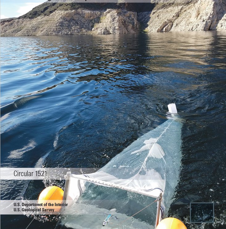
Earth’s waterways and oceans are awash with microplastics. The USGS has a strategic science vision for documenting and for prioritizing research to mitigate the impact on the environment and human society. pubs.usgs.gov/publication/ci… .

Earth’s waterways and oceans are awash with microplastics. The @USGS  has a strategic science vision for documenting #microplastics and for prioritizing research to mitigate the impact on the environment and human society.  pubs.usgs.gov/publication/ci… .
account_circle
USGS Earthquakes(@USGS_Quakes) 's Twitter Profile Photo

M3.8 in western Tennessee, within the New Madrid Seismic Zone. Weakly felt shaking reported to at least 200-300 km.
earthquake.usgs.gov/earthquakes/ev…

account_circle
Hawaii Volcanoes NPS(@Volcanoes_NPS) 's Twitter Profile Photo

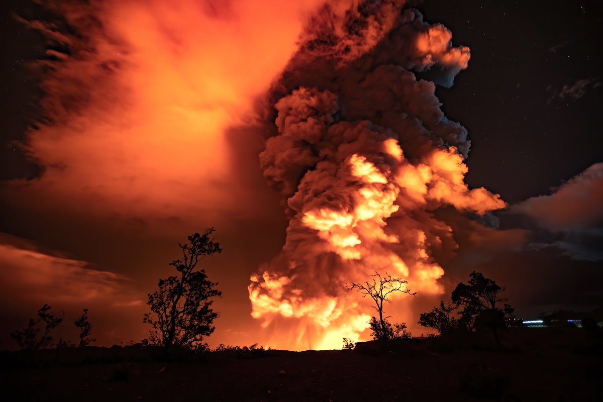
Happening now: a new eruption of Kīlauea inside Halemaʻumaʻu

See live webcams inside Halemaʻumaʻu, courtesy of USGS Hawaiian Volcano Observatory: go.nps.gov/1o1nze

Happening now: a new eruption of Kīlauea inside Halemaʻumaʻu

See live webcams inside Halemaʻumaʻu, courtesy of USGS Hawaiian Volcano Observatory: go.nps.gov/1o1nze
account_circle
USGS(@USGS) 's Twitter Profile Photo

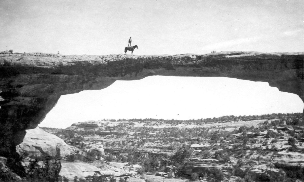
Check out this stunt by Dan Perkins on top of Utah's 106' tall Owachomo Bridge! It's the thinnest of the three natural bridges in Natural Bridges Nat'l Monument.

Owachomo means 'rock mound' in Hopi?

Now get off your high horse, Dan, and don't try this again.🐴

Check out this stunt by Dan Perkins on top of Utah's 106' tall Owachomo Bridge! It's the thinnest of the three natural bridges in Natural Bridges Nat'l Monument.

#DKY Owachomo means 'rock mound' in Hopi? 

Now get off your high horse, Dan, and don't try this again.🐴

#TBT #Utah
account_circle
USGS Astrogeology(@USGS_AstroGeo) 's Twitter Profile Photo

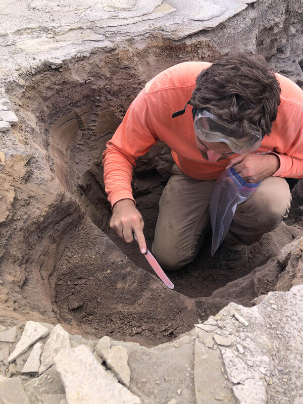
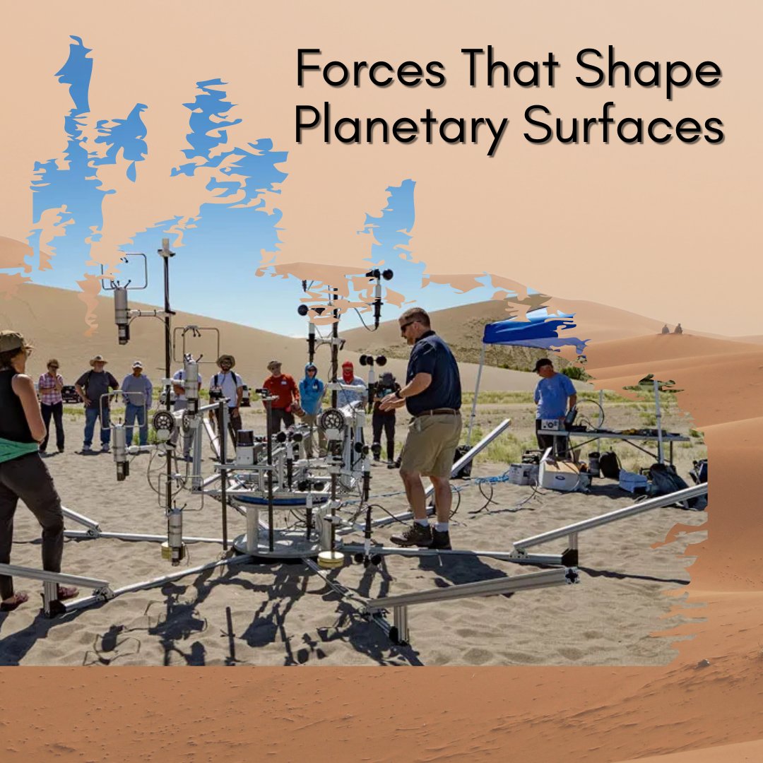
A team of scientists, including from Astrogeology, joined forces with to explore the planetary realm! At Bruneau Dunes State Park in Idaho, the group used a lander concept to observe interactions between the atmosphere and surfaces. Learn more: eos.org/science-update…

A team of scientists, including from Astrogeology, joined forces with #NASA to explore the planetary realm! At Bruneau Dunes State Park in Idaho, the group used a lander concept to observe interactions between the atmosphere and surfaces. Learn more: eos.org/science-update…
account_circle
Hawaii EMA(@Hawaii_EMA) 's Twitter Profile Photo

Digging a little deeper into Kīlauea’s 1924 eruptions and their impacts on communities is the focus of this week’s : usgs.gov/observatories/…

Digging a little deeper into Kīlauea’s 1924 eruptions and their impacts on communities is the focus of this week’s #VolcanoWatch: usgs.gov/observatories/…
account_circle
USGS Volcanoes🌋(@USGSVolcanoes) 's Twitter Profile Photo

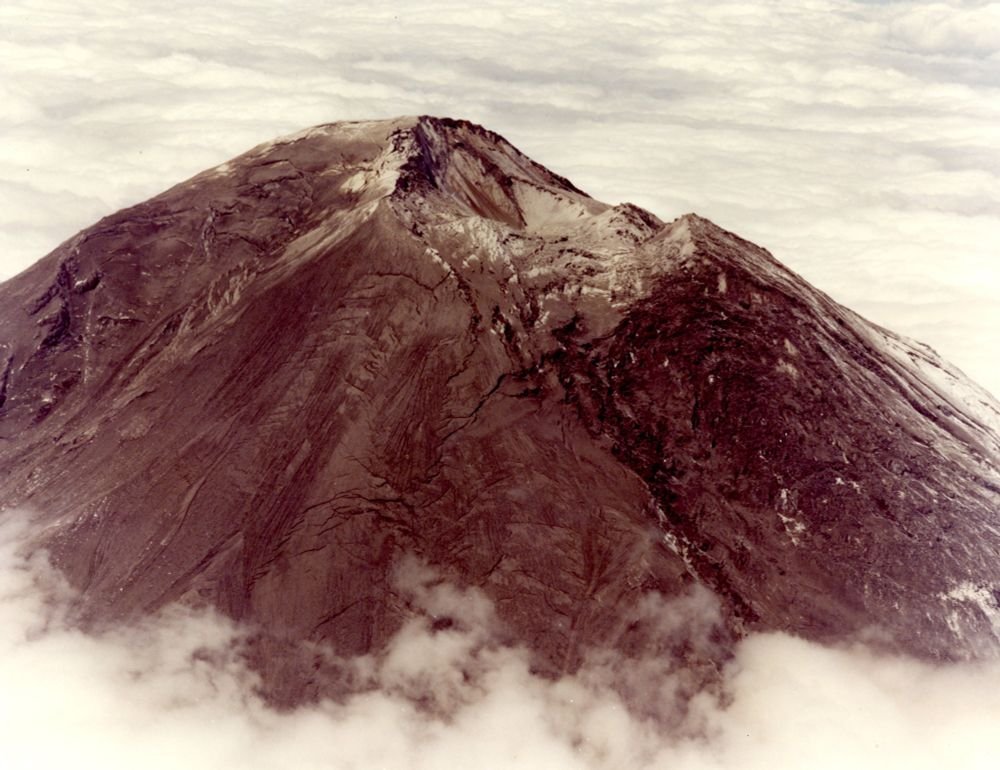
May is in WA. Today, meet , a site of continuous geologic change. Landslides tear the volcano apart while lava flows & domes work to rebuilt it. Large explosive eruptions blanketed the PNW with ash, lahars swept down valleys for tens of miles.
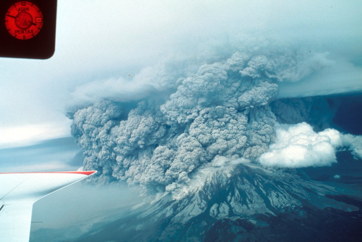

May is #VolcanoAwarenessMonth in WA. Today, meet #MountStHelens, a site of continuous geologic change. Landslides tear the volcano apart while lava flows & domes work to rebuilt it. Large explosive eruptions blanketed the PNW with ash, lahars swept down valleys for tens of miles.
account_circle
USGS Astrogeology(@USGS_AstroGeo) 's Twitter Profile Photo

Hey ! Looking for a fun, easy way to teach about the 2020 Perseverance rover? Check out this coloring sheet activity! Students color their own geologic map and learn about the geology of ! usgs.gov/news/coloring-…

Hey #Teachers! Looking for a fun, easy way to teach about the #Mars2020 Perseverance rover? Check out this #GeologicMap coloring sheet activity! Students color their own geologic map and learn about the geology of #Mars! usgs.gov/news/coloring-…
account_circle