Rob Mayeda(@RobMayeda) 's Twitter Profileg
Rob Mayeda

@RobMayeda

Bay Area AMS Meteorologist since 2003 CSU/SJSU Lecturer. Formerly KIRO, KCRA, KSBY, KESQ, KNBC, Arizona Daily Wildcat & dad of twinados 👦🏻🌪️👦🏻🌪️

ID:22802715

linkhttp://www.nbcbayarea.com calendar_today04-03-2009 17:22:55

75,6K Tweets

31,0K Followers

9,9K Following

Follow People
Rob Mayeda(@RobMayeda) 's Twitter Profile Photo

Region 3664 = Old Faithful for big solar flares …X 8.8 😲 group is no longer Earth facing however but still… wow.

account_circle
NASA's Kennedy Space Center(@NASAKennedy) 's Twitter Profile Photo

Setting the foundation for future missions 🚀

Teams with NASA's Exploration Ground Systems have been busy building a new mobile launcher to support the more powerful NASA_SLS Block 1B rocket that will be used in the NASA Artemis IV mission and beyond: go.nasa.gov/3ykIhxe

Setting the foundation for future #Artemis missions 🚀 Teams with @NASAGroundSys have been busy building a new mobile launcher to support the more powerful @NASA_SLS Block 1B rocket that will be used in the @NASAArtemis IV mission and beyond: go.nasa.gov/3ykIhxe
account_circle
Jan Null(@ggweather) 's Twitter Profile Photo

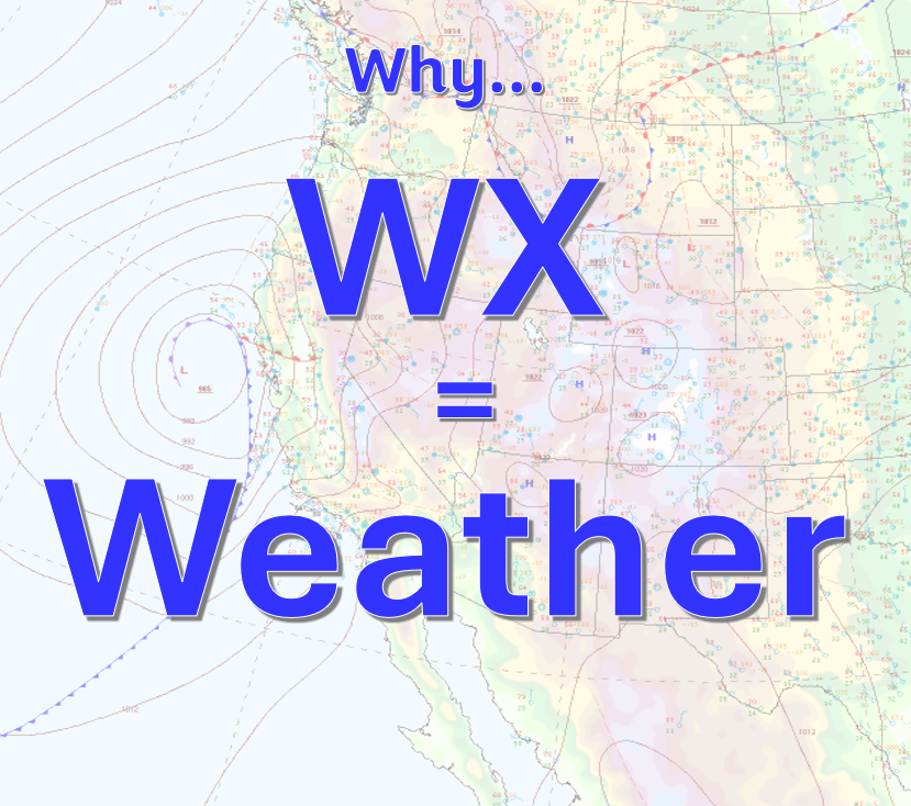
Most people in and around meteorology know, and have probably used the abbreviation WX as shorthand for “weather”. But, have you ever wondered about the origin of the abbreviation? I’ve used it for almost 50 years, and it was only recently that I found out how it originated.

Most people in and around meteorology know, and have probably used the abbreviation WX as shorthand for “weather”. But, have you ever wondered about the origin of the abbreviation? I’ve used it for almost 50 years, and it was only recently that I found out how it originated.
account_circle
Rob Mayeda(@RobMayeda) 's Twitter Profile Photo

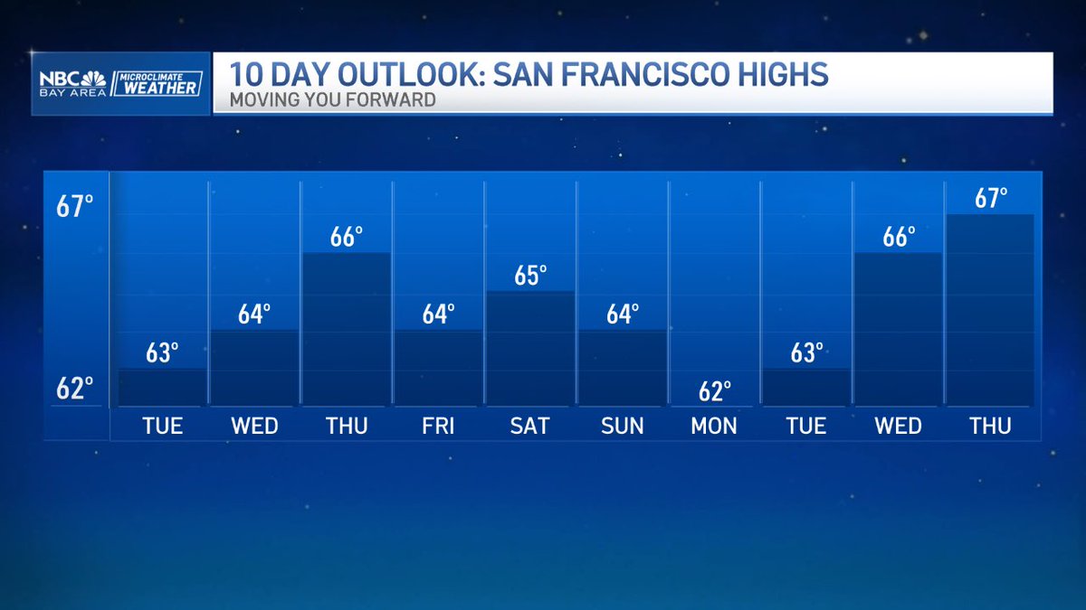
Today should be the coolest day of the week…especially inland East Bay valleys where temps are cooler than yesterday. Should see a modest warm-up midweek before some weekend cooling with eyes on a cut off flow offshore the Southern California coast into early next wk.

Today should be the coolest day of the week…especially inland East Bay valleys where temps are cooler than yesterday. Should see a modest warm-up midweek before some weekend cooling with eyes on a cut off flow offshore the Southern California coast into early next wk. #CAwx…
account_circle
Rob Mayeda(@RobMayeda) 's Twitter Profile Photo

AI enables many productive things not possible before, but perhaps we will look back on this era as the one before
AI believed it’s a better version of you and decided to act on it.

account_circle
Rob Mayeda(@RobMayeda) 's Twitter Profile Photo

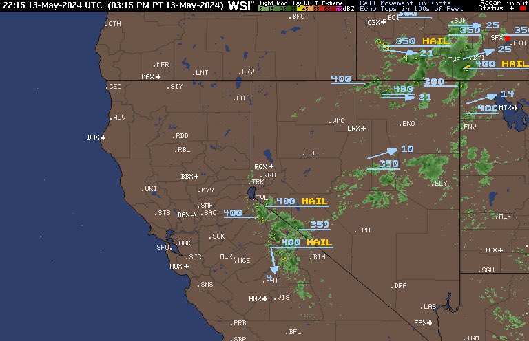
Nothing says pre-Summer mode along the Sierra like… daytime thunderstorm chances, in this case mostly south of Highway 50. You may notice some of these higher cloud tops from the Bay Area looking east over the next couple of days. 5/13/2024

account_circle
ALERTCalifornia(@ALERTCalifornia) 's Twitter Profile Photo

Our Rattlesnake Peak 2 camera captured spectacular footage of the Aurora Borealis over the weekend. All of ALERTCalifornia's footage is archived - let us know if you saw the aurora, and if so where and when. We'll check the cameras. Watch live 24/7 at cameras.alertcalifornia.org

account_circle
Prof. Mathew Owens(@mathewjowens) 's Twitter Profile Photo

'Eruption alley' has rotated around with AR3664. But as Earth gets out of the direct firing line, a new space-weather hazard presents itself. AR3664 is now close to the Earth-connected magnetic field line (white line), channelling any relativistic solar protons our way.

account_circle
Rob Mayeda(@RobMayeda) 's Twitter Profile Photo

“G4 conditions are no longer likely” = Not much aurora viewing opportunities near here. Reminder Friday was G4 to G5 5/12/2024 #

account_circle
☀️ Sara Housseal ☀️(@SNHWx) 's Twitter Profile Photo

Let’s talk about this a little more:

While there is still the potential for solar storm arrivals and sporadic activity over the coming days as Earth continues to be hit by fast solar wind, it is presumed that the peak of the storm(s) has passed. Heightened activity continues but…

account_circle
Rob Mayeda(@RobMayeda) 's Twitter Profile Photo

Why we are nowhere near those Friday night lights levels, a significant drop off followed into early Sunday. Next increase is expected shortly but currently not expected to match Friday’s. Current geomagnetic storm watch continues to 11pm Monday night. Stay tuned

account_circle