RadarOmega(@RadarOmega) 's Twitter Profile Photo

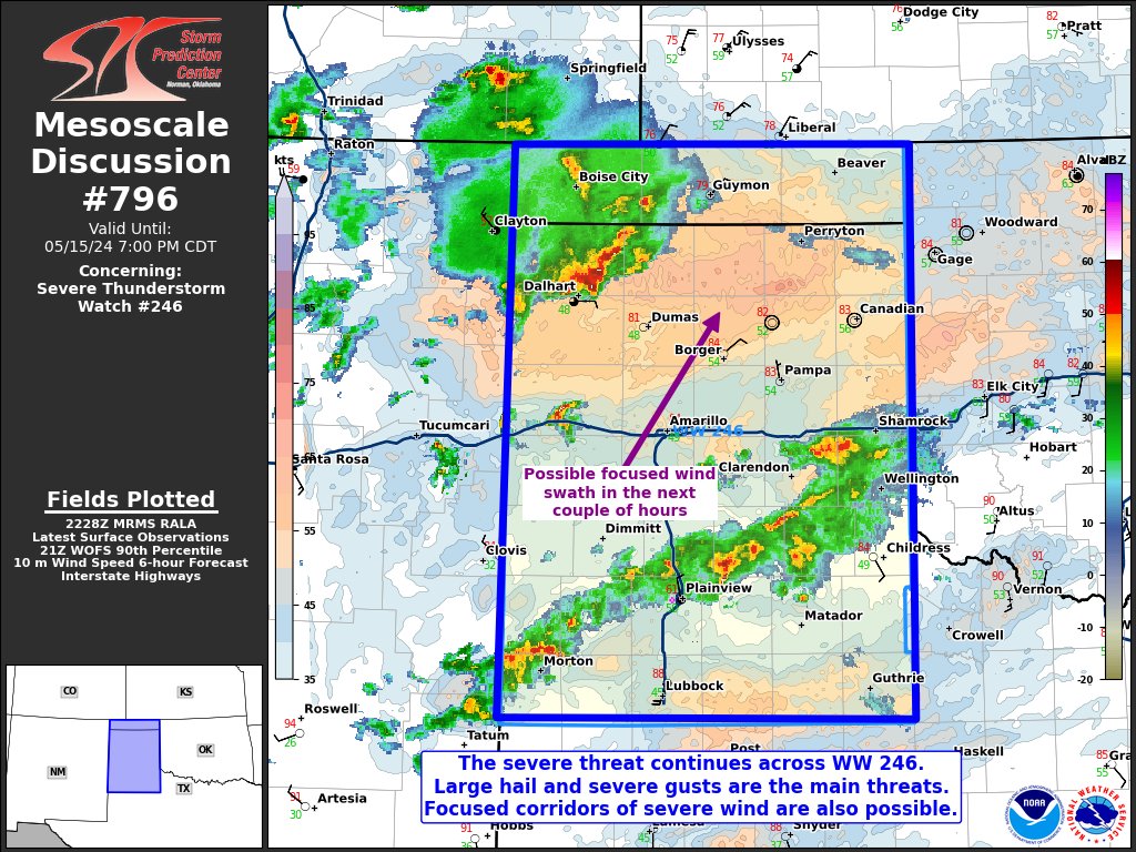
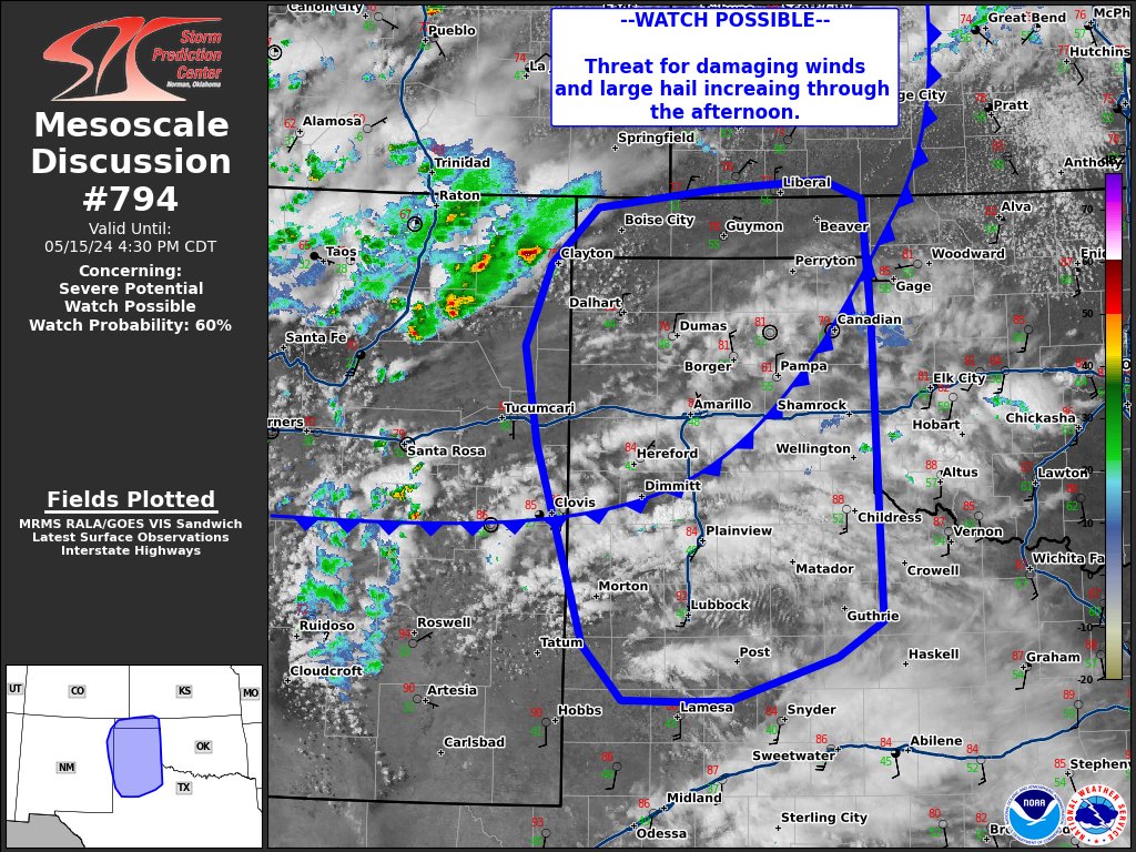
WATCH POSSIBLE: Visible satellite shows areas of cumulus developing across portions of eastern New Mexico into the Texas and Oklahoma Panhandles. says a watch is possible this afternoon as the potential for damaging winds and large hail increases!

account_circle
Grant Tosterud(@granttosterudwx) 's Twitter Profile Photo

*Almost* feels monsoon-like out there today... but it's not. Still nice to see all this rain on radar and for it to actually be making it to the ground! KRQE News 13

account_circle
Zoe Mintz(@wx_zoe) 's Twitter Profile Photo

There is the chance for severe weather across far northeastern New Mexico through this evening as storms strengthen on their way into Texas/Oklahoma. Large hail and damaging winds are the primary threats.

Albuquerque likely won't see severe storms, but rain is on the way👏

account_circle
NWS Albuquerque(@NWSAlbuquerque) 's Twitter Profile Photo

🚨Heads up to those of you in Clayton, a severe storm with hail up to ping pong ball size according to radar is heading southeast along U.S. 64/87. Please take shelter from this!

account_circle
NWS Albuquerque(@NWSAlbuquerque) 's Twitter Profile Photo

Storms are developing across the northeast highlands. These will move off into the plains during the afternoon.

Main risk will be strong damaging wind gusts of up to 60 mph. Penny to quarter size hail could be possible near the NM/OK/TX border later this afternoon.

account_circle
Zoe Mintz(@wx_zoe) 's Twitter Profile Photo

Scattered showers and storms have arrived to New Mexico, with a severe thunderstorm moving southeast towards Clayton right now. This storm has 50-60 mph wind gusts and ping-pong sized hail.

More severe storms will likely develop this afternoon and evening.

account_circle
NWS Albuquerque(@NWSAlbuquerque) 's Twitter Profile Photo

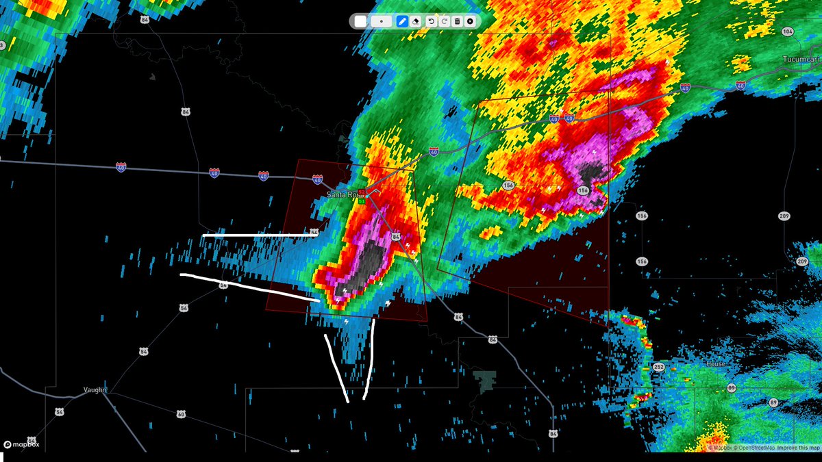
A storm coming from Laguna Pueblo is approaching I-40 at Laguna and Mesita. Could see some gusty winds and pea size hail from this storm.

account_circle
NWS Albuquerque(@NWSAlbuquerque) 's Twitter Profile Photo

Severe cell that impacted Clayton has now exited into the Texas Panhandle. A few cells that have developed in southeast Roosevelt and northern Lea County could be producing dime to nickel size hail.

account_circle
NWS El Paso(@NWSElPaso) 's Twitter Profile Photo

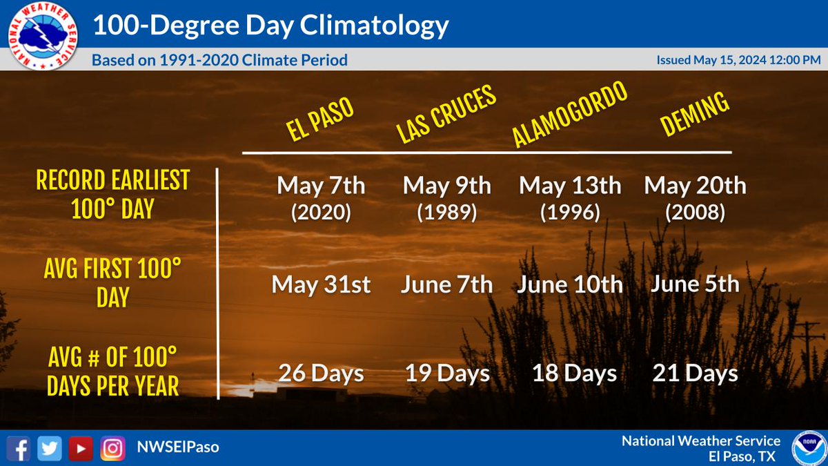
It's time to start talking about it... 🔥🌡️🫠

The warmup to summer is underway, so here's some climate facts on 100-degree days around southern New Mexico and far west Texas.

It's time to start talking about it... 🔥🌡️🫠

The warmup to summer is underway, so here's some climate facts on 100-degree days around southern New Mexico and far west Texas. #nmwx #txwx
account_circle
Corbin Voges WX(@CorbinVogesWX) 's Twitter Profile Photo

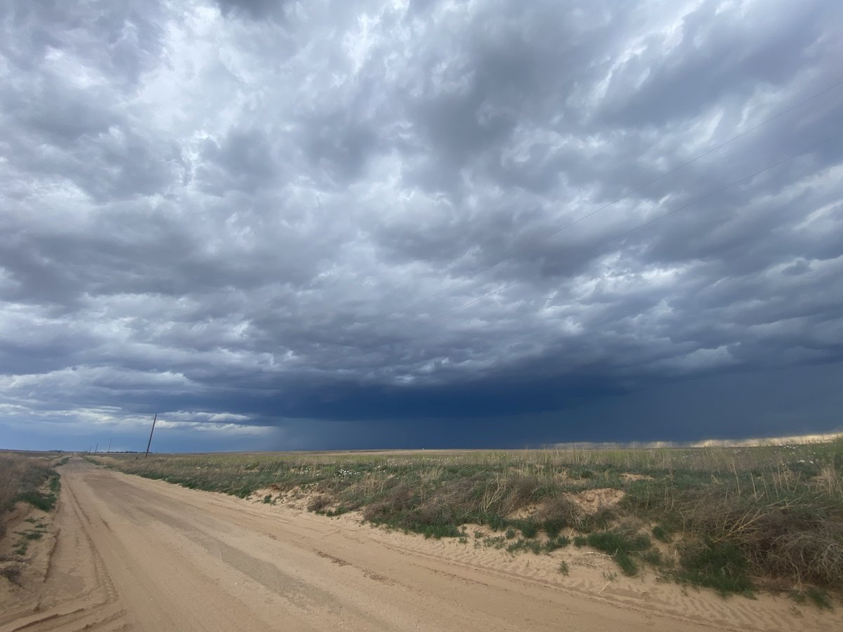
Here is a quick timelapse of the haboob that barreled through Dumas, Texas this evening. A haboob is a dust storm that originates from the strong winds of a thunderstorm. They are seen most often in the SW part of the U.S.
Storm Search 7 ABC 7 Amarillo The National Weather Desk

account_circle
NWS Albuquerque(@NWSAlbuquerque) 's Twitter Profile Photo

A strong cell is drifting northeast in southeast Roosevelt County. However, the severe hail looks to be in Texas just west of Morton.

account_circle
Zoe Mintz(@wx_zoe) 's Twitter Profile Photo

One of my favorite things about getting some rain in the desert is how GREEN everything gets a day or two afterwards🌧️💚

account_circle