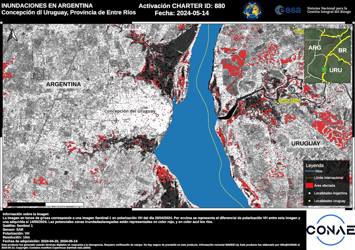
Our first maps of the flood in Argentina use #Sentinel1 data acquired yesterday to estimate the extent of floods along the Uruguay River at different locations in Entre Ríos Province: bit.ly/3UZoBrz

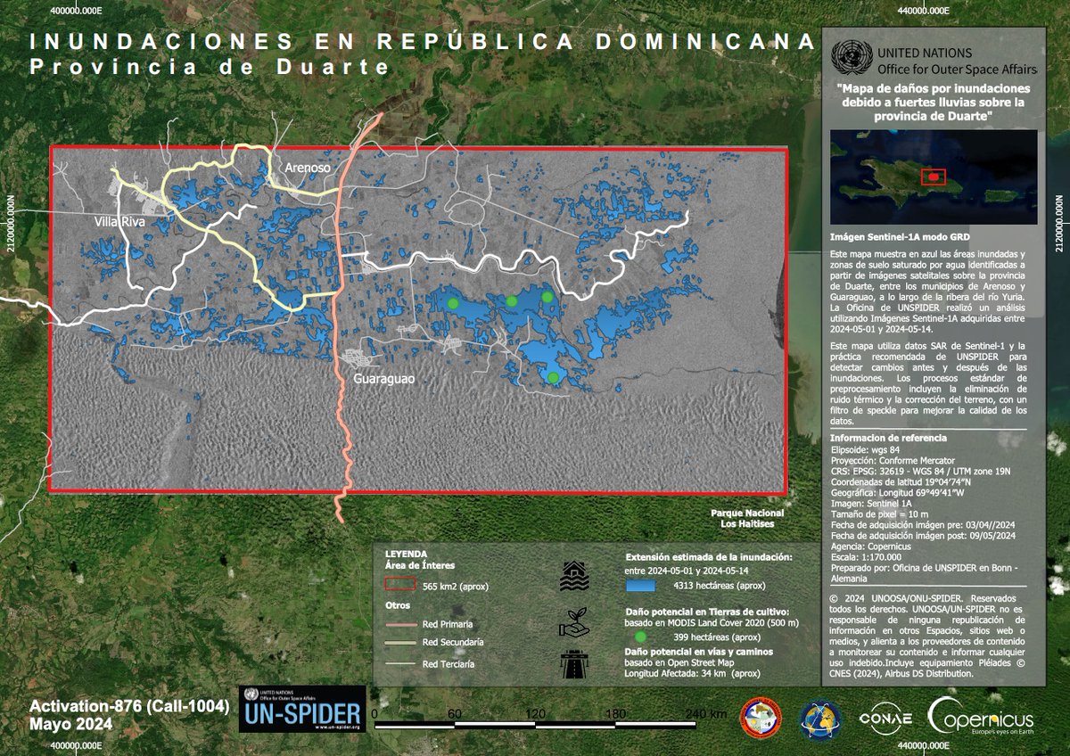
This map uses #Sentinel1 data from 1 and 14 May to estimate the impact of flooding in Duarte Province, Dominican Republic: bit.ly/4dE4I0w

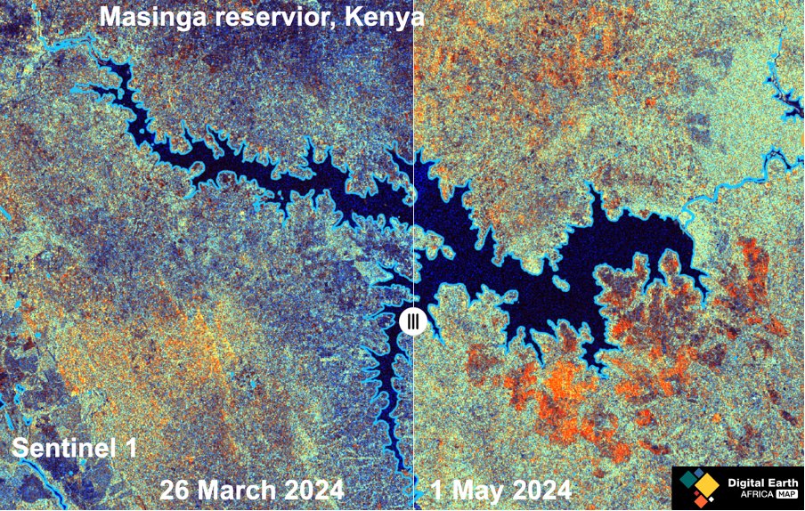
Digital Earth Africa is changing the game with its analysis-ready #Sentinel1 Synthetic Aperture Radar (SAR) for the entire continent. This revolutionary technology has the capability to 'see through' clouds, making it critical for mapping and monitoring land cover changes in the wet

Imagens SAR do #SENTINEL1 que acabam de ser processadas pela NOAA UW-Madison SSEC estão disponíveis em: shorturl.at/arvxN / #SENTINEL1 SAR imagery just processed by NOAA UW-Madison SSEC are available at: shorturl.at/arvxN
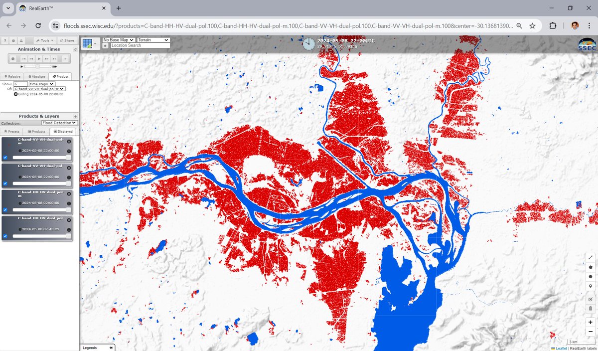

#floods in #Brazil #PortoAlegre #RS
Unfortunately, there is still a lot of water on areas where it does not belong.
📸🛰 #Sentinel1 💪👍 2019.05.08 vs. 2024.05.11
cc Thomas Ormston
H/t Sérgio OSMsmaprs
Composición de imágenes de radar obtenidas por el satélite #Sentinel1 🇲🇽, volcan #Popocatepetl (enero - octubre 2023) 🌋
🖊️Es evidente que durante los primeros meses del 2023 se produjo un llenado del cráter interno que culminó con una intensa actividad explosiva en mayo y

🔴⚠️🌨🇩🇪🇳🇱Severe #flood conditions in N. #Europe after the recent storms.The
#Rhine river overflew for several Kms in #Germany with record levels and floods also in #Netherlands . Here the situation as of Dec.27 by #sentinel1 at the borders of the 2 countries. #ClimateEmergency

Orsk, also seen with
🛰 #Sentinel1 2021.04.08. vs 2024.04.08
A lot of flooding there..... stay healthy
Footage: Copernicus EU Sentinel Hub

Chasm and Rifts - Filchner Ice Shelf in Antarctic entering the Weddell Sea. 91 #Copernicus #Sentinel1 🛰️ condensed in 2 seconds and acquired between 2014 and 2023.

🔴⚠️🌨🏴In the aftermath of #StormHenk S. #England is affected by #floods in multiple areas. Here a #sentinel1 + #sentinel2 visualization shows the flooded locations around #Nottingham for more than 50km along the river #Trent .More floods also south of the city. #ClimateEmergency

#CopernicusEmergency Use Cases
The University of Arizona has conducted a study comparing different approaches using #Sentinel1 🛰️ data to accurately map the floods in #Bangladesh 🇧🇩 during May & June 2022
➡️Our #GFM tool was one of the methods evaluated🌊
More at👇
global-flood.emergency.copernicus.eu/get-involved/e…


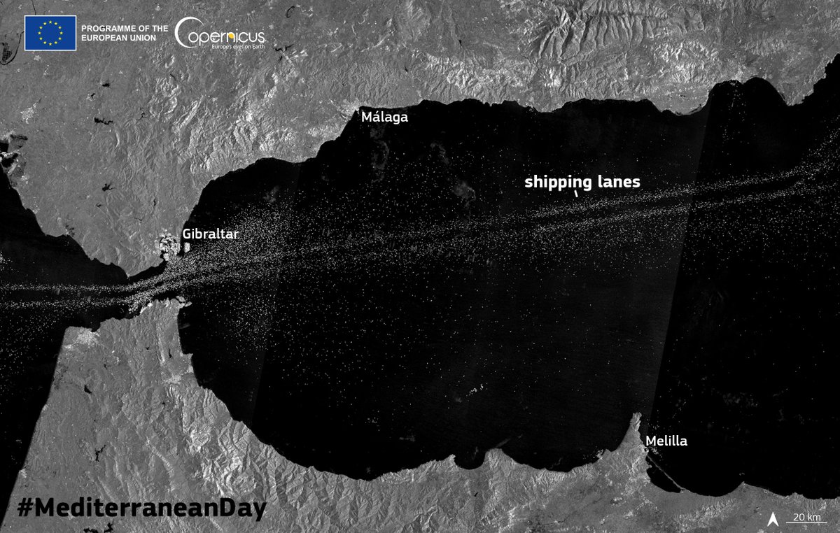
Negociaciones entre España, Reino Unido y la UE sobre Gibraltar 🤔. En esta imagen del satélite #Sentinel1 vemos el tráfico marítimo en el estrecho de Gibraltar y nos pone en contexto sobre lo que hay en juego una parte importante del tráfico marítimo mundial ¿Creéis qué los

Caldera de Taburiente National Park - November 2023
Welcome to La Palma, a spectacular island dominated by this eight-kilometre-wide cleft in the Canary Islands. Also an Unesco Biosphere Reserve. #SAR is also beautiful.
#Copernicus #Sentinel1 🛰️
HD: youtu.be/57vYpp2wQd4 🧐

#Ruang #volcano before & after the eruption
Take a closely view on the summit crater
📸🛰 #Sentinel1 delivered beautiful shots for a comparison
Footage: Copernicus EU Sentinel Hub
Global Volcanism Program h/t CultureVolcan


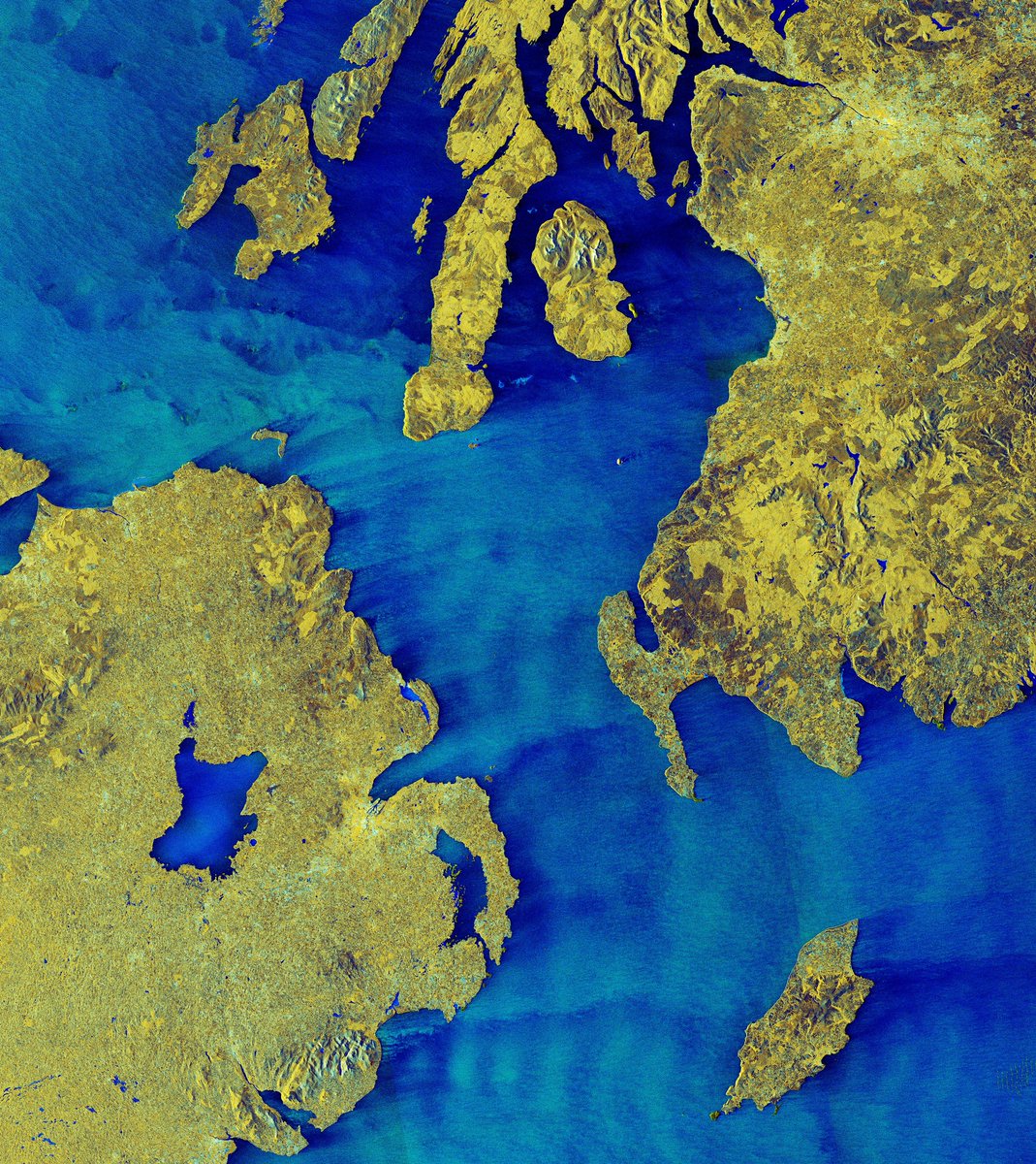
📷 This week's ESA Earth Observation #EarthFromSpace shows the North Channel, between Northern Ireland and Scotland, in this false-colour radar image taken by Copernicus EU #Sentinel1 .

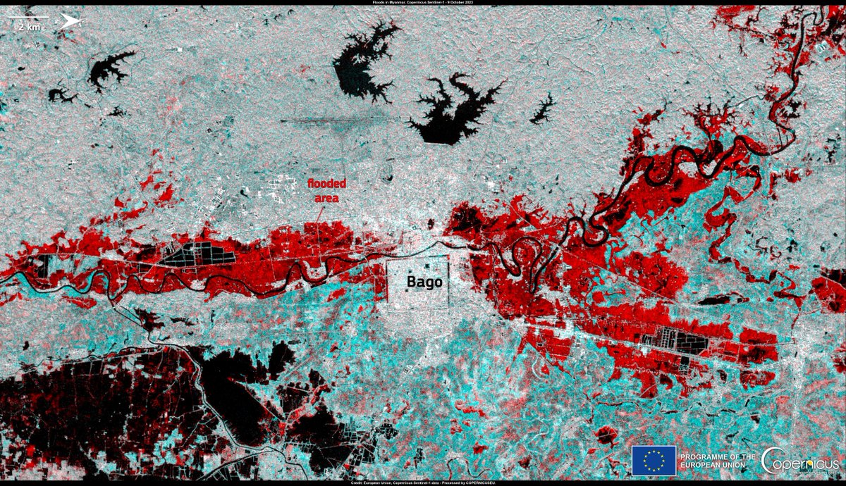
Heavy monsoon rains and floods are impacting #Myanmar .
Authorities report 5 casualties and close to 15,000 people displaced.
This is why #EarlyWarningsForAll is WMO's top priority.
Flooded areas (in red) can be seen in #Sentinel1 radar image of 8 Oct.
Via Copernicus EU
Read our Sentinel Benefit Study #SeBS & discover how Copernicus EMS, fueled by #Sentinel1 data, can craft accurate flood maps. These maps drive informed decisions and offer economic & social benefits from the national level down to citizens.
European Space Agency ➡️ earsc.org/sebs/flood-man…
