Kelly Foster(@Kelly_WPMI) 's Twitter Profileg
Kelly Foster

@Kelly_WPMI

Morning News Anchor/AMS & NWA Sealed Meteorologist Local 15 WPMI-TV Mobile, AL-Pensacola/Ft. Walton Beach, FL

ID:588282074

linkhttp://www.local15tv.com/weather calendar_today23-05-2012 13:21:06

9,7K Tweets

5,1K Followers

561 Following

Kelly Foster(@Kelly_WPMI) 's Twitter Profile Photo

Strong to severe storms possible Fri. Take a look at the timeline below. Primary threats: damaging (60MPH) winds, hail, flooding & a brief tornado. Make sure you have several ways to receive warnings. NBC 15 News mync15.com/weather
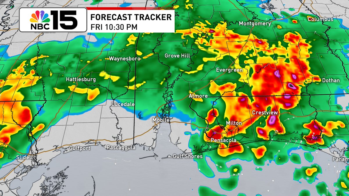
Strong to severe storms possible Fri. Take a look at the timeline below. Primary threats: damaging (60MPH) winds, hail, flooding & a brief tornado. Make sure you have several ways to receive warnings. @mynbc15 mync15.com/weather
account_circle
Kelly Foster(@Kelly_WPMI) 's Twitter Profile Photo

Level 1 severe risk Thu PM. Rounds of storms Fri AM-Sat AM with Level 2 (slight) risk in yellow areas & Level 1 in green areas. Threats: damaging winds (60mph), large hail & a stray tornado. Excessive rainfall risk Fri; rain amounts of 2' to 5' with 6'possible NBC 15 News
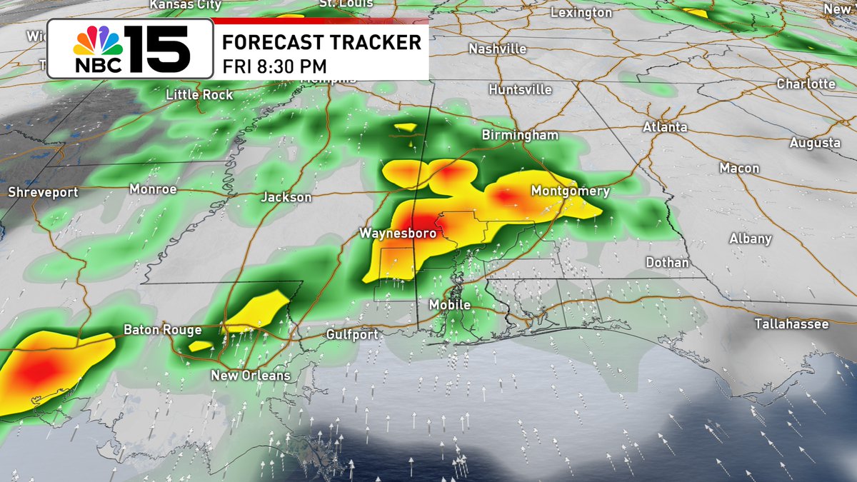
Level 1 severe risk Thu PM. Rounds of storms Fri AM-Sat AM with Level 2 (slight) risk in yellow areas & Level 1 in green areas. Threats: damaging winds (60mph), large hail & a stray tornado. Excessive rainfall risk Fri; rain amounts of 2' to 5' with 6'possible @mynbc15
account_circle
Kelly Foster(@Kelly_WPMI) 's Twitter Profile Photo

Rain shifts out after lunch Tue with Flood Watch until 1PM. We get a break in the rain Wed & during the day Thu. An unsettled pattern kicks off Fri into the weekend NBC 15 News mynbc15.com/weather
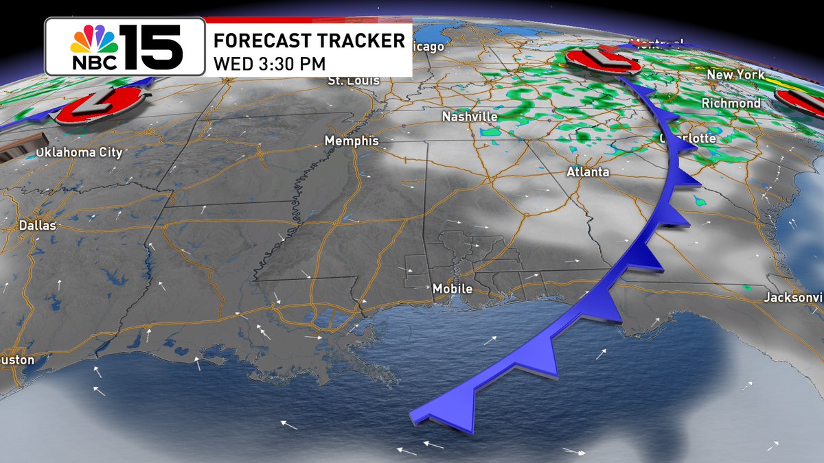
Rain shifts out after lunch Tue with Flood Watch until 1PM. We get a break in the rain Wed & during the day Thu. An unsettled pattern kicks off Fri into the weekend @mynbc15 mynbc15.com/weather
account_circle
Kelly Foster(@Kelly_WPMI) 's Twitter Profile Photo

Overnight storms bring a Level 2 risk of severe weather coastal & level 1 inland until 7AM Tue. Then it changes to a slight risk Tue for S zones of our FL Panhandle counties, marginal for our SW AL counties. Flood Watch coastal until 1PM Tue NBC 15 News mynbc15.com/weather
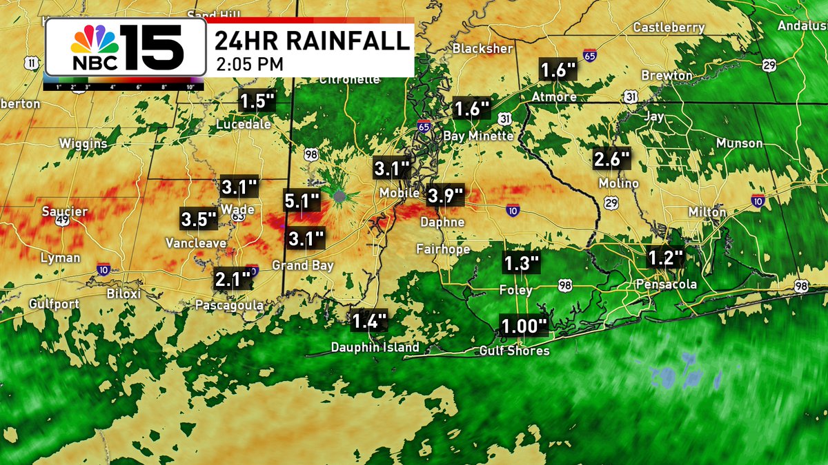
Overnight storms bring a Level 2 risk of severe weather coastal & level 1 inland until 7AM Tue. Then it changes to a slight risk Tue for S zones of our FL Panhandle counties, marginal for our SW AL counties. Flood Watch coastal until 1PM Tue @mynbc15 mynbc15.com/weather
account_circle
Kelly Foster(@Kelly_WPMI) 's Twitter Profile Photo

A second round of t-storms is forecast to march through overnight while you sleep. While exact timing is not set in stone, don't be caught off guard. NBC 15 News mynbc15.com/weather
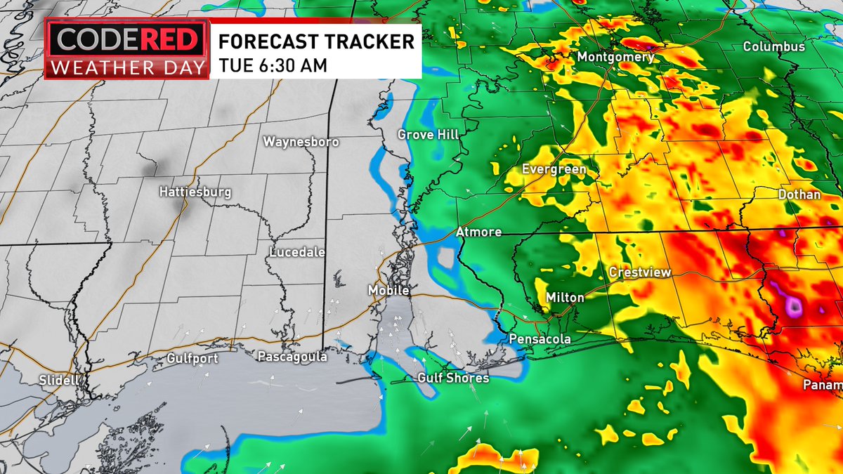
A second round of t-storms is forecast to march through overnight while you sleep. While exact timing is not set in stone, don't be caught off guard. @mynbc15 mynbc15.com/weather
account_circle
Kelly Foster(@Kelly_WPMI) 's Twitter Profile Photo

Multiple rounds of t-storms ahead. While the exact timing is not set in stone, the first round looks to march in before sunrise Mon & lingers through lunchtime. Another round arrives late Mon afternoon lasting overnight until daybreak Tue NBC 15 News mynbc15.com/weather
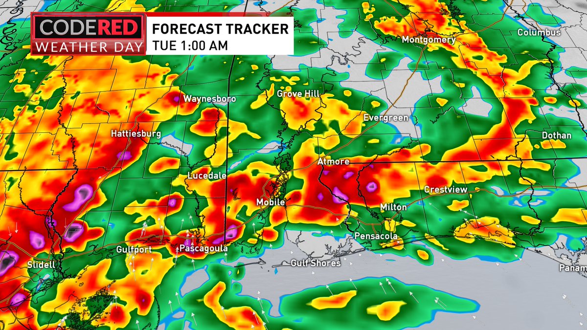
Multiple rounds of t-storms ahead. While the exact timing is not set in stone, the first round looks to march in before sunrise Mon & lingers through lunchtime. Another round arrives late Mon afternoon lasting overnight until daybreak Tue @mynbc15 mynbc15.com/weather
account_circle
Kelly Foster(@Kelly_WPMI) 's Twitter Profile Photo

Level 2 (slight) severe risk Mon AM-Tue AM. Next weathermaker will unleash t-storms capable of producing damaging winds, large hail, even a few tornadoes. Flood Watch with 3'-6' of rain forecast & up to 8' possible in some areas. NBC 15 News mynbc15.com/weather
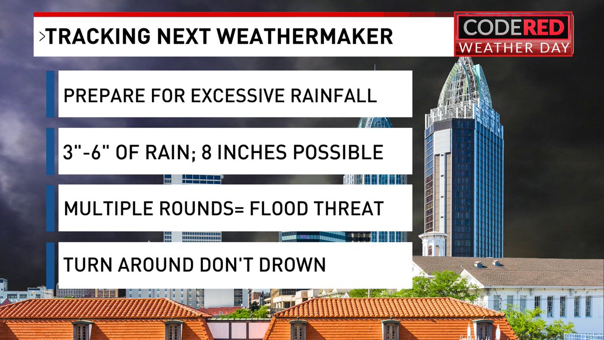
Level 2 (slight) severe risk Mon AM-Tue AM. Next weathermaker will unleash t-storms capable of producing damaging winds, large hail, even a few tornadoes. Flood Watch with 3'-6' of rain forecast & up to 8' possible in some areas. @mynbc15 mynbc15.com/weather
account_circle
Kelly Foster(@Kelly_WPMI) 's Twitter Profile Photo

Level 1 (marginal) risk of severe weather today before 1PM. Beautiful weather is in store for Mother's Day weekend NBC 15 News mynbc15.com/weather
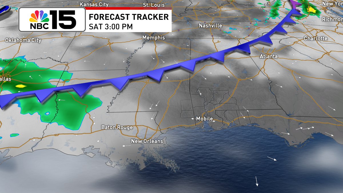
Level 1 (marginal) risk of severe weather today before 1PM. Beautiful weather is in store for Mother's Day weekend @mynbc15 mynbc15.com/weather
account_circle
Kelly Foster(@Kelly_WPMI) 's Twitter Profile Photo

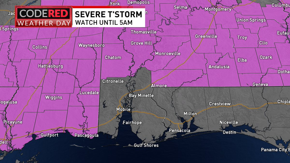
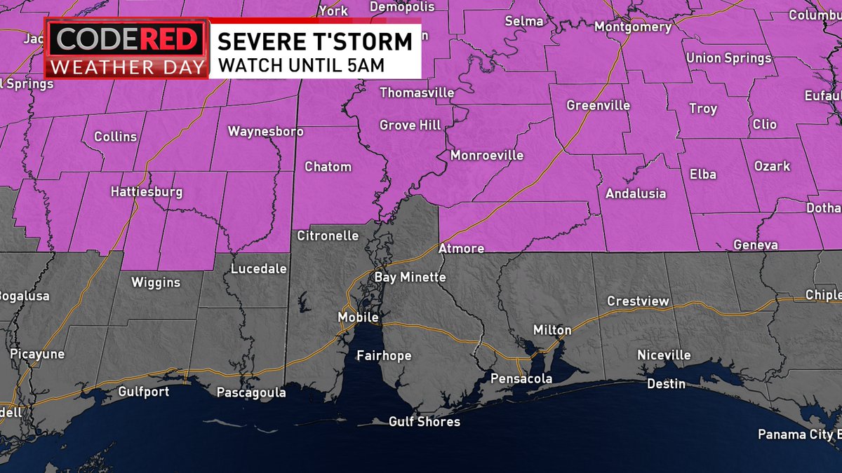
Update to our Thunderstorm Watch. It now covers all of our inland counties in SW Alabama and SE Mississippi until 5AM. NBC 15 News mynbc15.com/weather

Update to our #Severe Thunderstorm Watch. It now covers all of our inland counties in SW Alabama and SE Mississippi until 5AM. @mynbc15 mynbc15.com/weather
account_circle
Kelly Foster(@Kelly_WPMI) 's Twitter Profile Photo

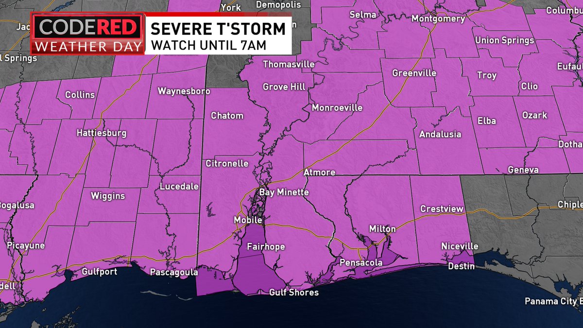
CODE RED WEATHER possible while you sleep. Atmosphere is conducive for significant severe weather with damaging winds & large hail being the main threats NBC 15 News mynbc15.com/weather

CODE RED WEATHER possible while you sleep. Atmosphere is conducive for significant severe weather with damaging winds & large hail being the main threats #alwx #flwx #mswx @mynbc15 mynbc15.com/weather
account_circle
Kelly Foster(@Kelly_WPMI) 's Twitter Profile Photo

CODE RED WEATHER Fri AM. Enhanced (Level 3) risk of severe weather for the entire NBC 15 area. Have multiple ways to receive warnings. Numerous severe storms possible. Primary threats: damaging wind gusts (60 to 80mph), golf ball sized hail & a tornado can't be ruled out NBC 15 News
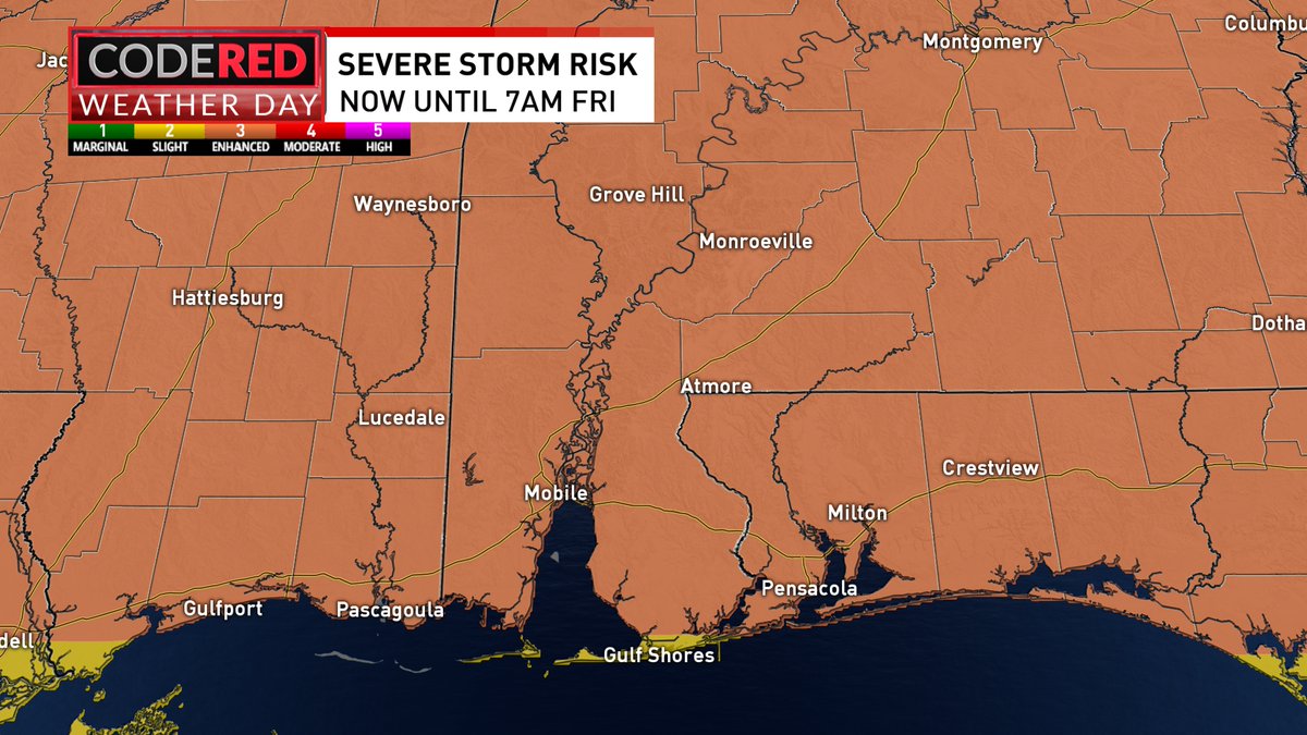
CODE RED WEATHER Fri AM. Enhanced (Level 3) risk of severe weather for the entire NBC 15 area. Have multiple ways to receive warnings. Numerous severe storms possible. Primary threats: damaging wind gusts (60 to 80mph), golf ball sized hail & a tornado can't be ruled out @mynbc15
account_circle
Kelly Foster(@Kelly_WPMI) 's Twitter Profile Photo

Timeline for Weather with Enhanced (level 3 out of 5) risk of severe weather N of I-10. Slight (level 2) for the rest of us. Primary threats: damaging winds 70+mph, golf ball sized hail, & a tornado can't be ruled out NBC 15 News mynbc15.com/weather

Timeline for #CODERED Weather with Enhanced (level 3 out of 5) risk of severe weather N of I-10. Slight (level 2) for the rest of us. Primary threats: damaging winds 70+mph, golf ball sized hail, & a tornado can't be ruled out @mynbc15 mynbc15.com/weather
account_circle
Kelly Foster(@Kelly_WPMI) 's Twitter Profile Photo

CODE RED WEATHER Fri AM. Enhanced (Level 3 out of 5) severe risk for areas along & N of Highway 84. Slight (Level 2) covers the rest. Timing: Thu PM- Fri AM. Primary threats: damaging winds 60-70mph, up to 75 mph in enhanced risk area & large hail. Low tornado threat NBC 15 News
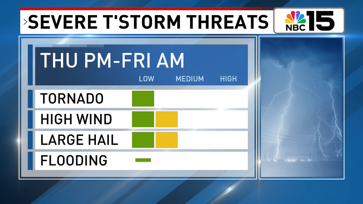
CODE RED WEATHER Fri AM. Enhanced (Level 3 out of 5) severe risk for areas along & N of Highway 84. Slight (Level 2) covers the rest. Timing: Thu PM- Fri AM. Primary threats: damaging winds 60-70mph, up to 75 mph in enhanced risk area & large hail. Low tornado threat @mynbc15
account_circle
Kelly Foster(@Kelly_WPMI) 's Twitter Profile Photo

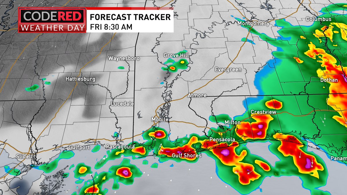
Level 2 severe risk Thu PM-Fri AM. Exact timing & location on recent models are different but consistent that t-storms will roll through while you sleep Fri AM. Primary threats: damaging winds (70mph) & half-dollar size hail NBC 15 News mynbc15.com/weather

Level 2 severe risk Thu PM-Fri AM. Exact timing & location on recent models are different but consistent that t-storms will roll through while you sleep Fri AM. Primary threats: damaging winds (70mph) & half-dollar size hail @mynbc15 mynbc15.com/weather
account_circle