NASA Goddard(@NASAGoddard) 's Twitter Profile Photo

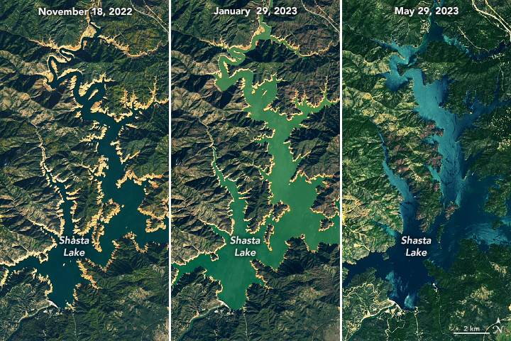
images show California’s largest reservoir, Shasta Lake, filled to nearly 100 percent capacity in May 2023. Images also show the second-largest reservoir, Lake Oroville, was near capacity at 97 percent in May.

Learn more: go.nasa.gov/3N8Q7gS

#Landsat images show California’s largest reservoir, Shasta Lake, filled to nearly 100 percent capacity in May 2023. Images also show the second-largest reservoir, Lake Oroville, was near capacity at 97 percent in May.

Learn more: go.nasa.gov/3N8Q7gS
account_circle
Iban Ameztoy(@i_ameztoy) 's Twitter Profile Photo

I cannot forget to mention Programs like Copernicus EU and NASA Landsat Program which make all this possible. Remember that what I am showing here is just the part of the huge domain. 3/4

I cannot forget to mention #OpenData Programs like @CopernicusEU and @NASA_Landsat which make all this possible. Remember that what I am showing here is just the #datavis part of the huge #EarthObservation domain. 3/4
account_circle
Ladies of Landsat(@LadiesOfLandsat) 's Twitter Profile Photo

.Trixi & Schmitt (2019) used classification & unbiased area estimation to map extent & change in the using mosaic data in support of + initiatives. bit.ly/Estomata_2019

.@Trixie_EA & Schmitt (2019) used #decisiontree classification & unbiased area estimation to map #forestcover extent & change in the #Philippines using #ALOS #PALSAR mosaic data in support of #REDD+ initiatives. #LoLManuscriptMonday bit.ly/Estomata_2019
account_circle
🏴‍☠️Roland(@AbsorbUnderwear) 's Twitter Profile Photo

Sander Ukr_Freedom000 Tried to find the location on the map and looked right at it zooming in randomly. It's next to a highway south of Donetsk. Looks like a shooting range. No Landsat or Sentinel available yet

47.91693258856328, 37.72967107697865

@SanderRegter @Ukr_Patriot777 Tried to find the location on the map and looked right at it zooming in randomly. It's next to a highway south of Donetsk. Looks like a shooting range. No Landsat or Sentinel available yet

47.91693258856328, 37.72967107697865
account_circle
Saverio Francini(@saveriofrancini) 's Twitter Profile Photo

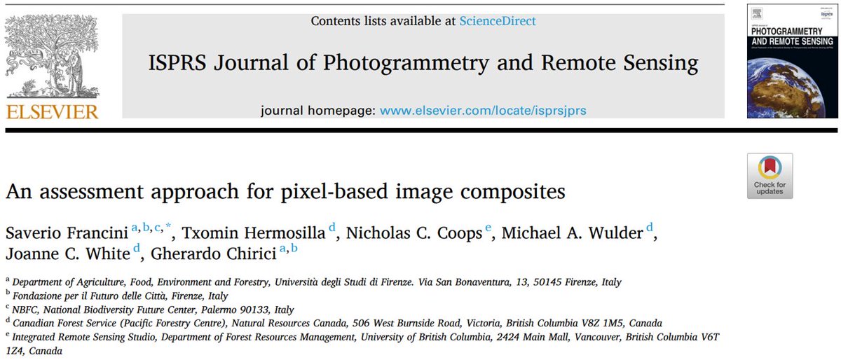
📢📢📢 out in ISPRS
Journal of Photogrammetry and Remote Sensing!!!

It is about assessing pixel-based composites, which should be the first key step in many applications.

doi.org/10.1016/j.ispr…

BAP

📢📢📢#NewPaper out in @isprs
Journal of Photogrammetry and Remote Sensing!!!

It is about assessing pixel-based composites, which should be the first key step in many #RemoteSensing applications. 

doi.org/10.1016/j.ispr…

#Landsat #GoogleEarthEngine #GEE #GEEBAP #OpenAccess
account_circle
Martin Kelko(@MKelko) 's Twitter Profile Photo

Strong paroxysm episode at Krakatau continues!
After nearly 24 hours since the recent paroxysm phase, yet another such lava-fountaining episode took place at the volcano early this morning.
NASA Landsat Program Sinergise PVMBG Global Volcanism Program Pierre Markuse

Strong paroxysm episode at Krakatau continues!
After nearly 24 hours since the recent paroxysm phase, yet another such lava-fountaining episode took place at the volcano early this morning. 
@NASA_Landsat @sinergise @PVMBG_ @SmithsonianGVP @Pierre_Markuse
account_circle
Orkun Turgay(@_orkunt) 's Twitter Profile Photo

Landsat-9 çıktı çıkalı yaklaşık 1 yıl olacak hiç bir uzaktan algılamacı daha maden yatakları için kullanmadı, yayın yapmadı..

account_circle
SatWorld(@or_bit_eye) 's Twitter Profile Photo

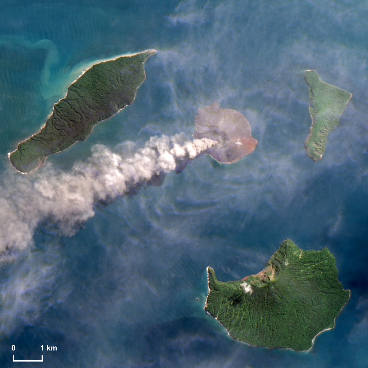
⚠️🔴🌋🇮🇩 Fountains of lava and long plumes of ash and gases: the has woken up again in the last few days.This 8 image shows the activity on June 9, while today a new ash plume reached more than 3km of height MAGMA Indonesia

⚠️🔴🌋🇮🇩 Fountains of lava and long plumes of ash and gases: the #Anak #Krakatau has woken up again in the last few days.This #Landsat 8 image shows the #volcano activity on June 9, while today a new ash plume reached more than 3km of height #Indonesia #volcaniceruption @id_magma
account_circle
Mirek Havránek(@HavrMiro) 's Twitter Profile Photo

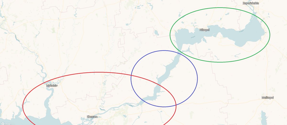
1/ I have decided to post here a pictures of development of Kakhovka reservoir using Sentinel & Landsat data.
I have divided area in to three areas of interest - upper reservoir (green) , lower reservoir (blue) and river delta beyond dam (red).

1/ I have decided to post here a pictures of development of Kakhovka reservoir using Sentinel & Landsat data. 
I have divided area in to three areas of interest - upper reservoir (green) , lower reservoir (blue) and river delta beyond dam (red).
#KakhovkaDam  #UkraineWar
account_circle
NASA Earth(@NASAEarth) 's Twitter Profile Photo

Refill, please! 🥛

Shasta Lake, California’s largest reservoir, filled to nearly 100% capacity last month. Heavy rains and meltwater from an above-average snowpack earlier this year helped counter a prolonged drought. go.nasa.gov/43Pmok7

watched it fill up ⤵️

Refill, please! 🥛

Shasta Lake, California’s largest reservoir, filled to nearly 100% capacity last month. Heavy rains and meltwater from an above-average snowpack earlier this year helped counter a prolonged drought. go.nasa.gov/43Pmok7 

#Landsat watched it fill up ⤵️
account_circle
Iban Ameztoy(@i_ameztoy) 's Twitter Profile Photo

Image update ⚠️ | Before/after situation in the area of city & surroundings. Images acquired by satellite between the 1st and 9th of June, 2023. Flooded areas can be clearly seen in this false color composite.

RussiaWar

account_circle
Paul Gaskin 🌲🍁 🌲 (he/il/él)(@PaulGaskinCFS) 's Twitter Profile Photo

Having and experts like Dr. Joanne C. White, Txomin Hermosilla and Mike Wulder at the Canadian Forest Service is, for lack of a better pun, 'far out.'
Give them a follow and/or have a look at some of their work:

cfs.nrcan.gc.ca/publications?i…

sciencedirect.com/science/articl…
Having #RemoteSensing and #LandSat experts like @Joanne_C_White, @txominhermos and @mikewulder at the Canadian Forest Service is, for lack of a better pun, 'far out.'
Give them a follow and/or have a look at some of their work: 

cfs.nrcan.gc.ca/publications?i…

sciencedirect.com/science/articl…
account_circle
Nordace(@NordaceOfficial) 's Twitter Profile Photo

🌵 Who needs ordinary when you can have a backpack infused with the spirit of the desert? 🏜️ It's my trusty companion, guiding me through rugged terrains and inspiring endless exploration. Adventure is calling, and I'm ready to answer!

account_circle
NASA Landsat Program(@NASA_Landsat) 's Twitter Profile Photo

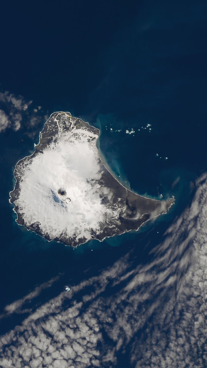
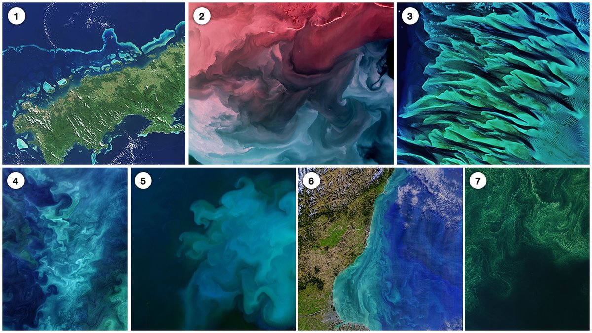
We're combining with to share how Landsat views these vast bodies of water 🌊🔎

Download your favorite phone wallpaper and explore how has contributed to the study of our planet's oceans for over 50 years.

We're combining #NationalOceanMonth with #WallpaperWednesday to share how Landsat views these vast bodies of water 🌊🔎

Download your favorite phone wallpaper and explore how #Landsat has contributed to the study of our planet's oceans for over 50 years.
account_circle