Thank you for the feature Ladies of Landsat #LoLManuscriptMonday
#IIRS #ISRO #RemoteSensing 🛰

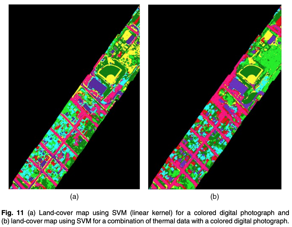
.Dr Richa Marwaha et al. (2015) compare the effectiveness of pixel- and object-based approaches for classifying land cover using long-wave infrared thermal hyperspectral and digital aerial photograph data near Thetford Mines, Quebec. #LoLManuscriptMonday bit.ly/Marwaha_2015

Thank you Ladies of Landsat! Feeling so honored to have our work featured in your #LoLManuscriptMonday !! ❤️

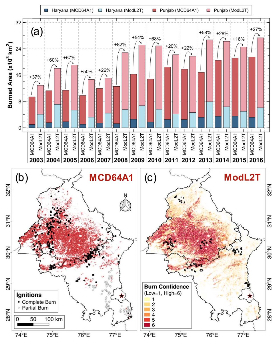
Thanks Ladies of Landsat for highlighting our manuscript on #India agricultural fires 🔥 for #LoLManuscriptMonday !! 🤗 w/ Ruth DeFries, Alex Karambelas, Meha Jain and other co-authors!
Very happy that our latest paper was featured on Ladies of Landsat #LoLManuscriptMonday ! A true honor 📊📈🛰️🌎
I am Very happy that my manuscript was selected for the #LoLManuscriptMonday of Ladies of Landsat Università di Firenze!!!!😊😊😊📡🌳🌲🌳🌲🎉🎊

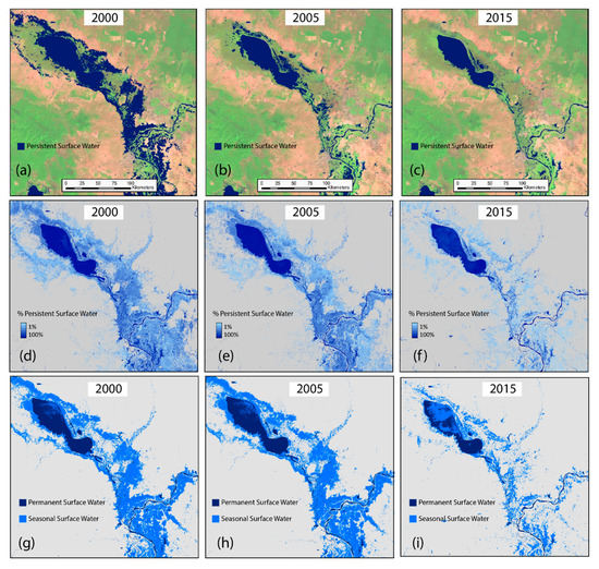
.Dr. Raha Hakimdavar et al. (2020) illustrate how #EO data can inform #SDG6 reporting by mapping surface water extent, quality and mangrove extent using freely available data from #MODIS , #Landsat 5, 7, 8, #Sentinel1 , #Sentinel2A & #SRTM . #LoLManuscriptMonday bit.ly/Hakimdavar_2020

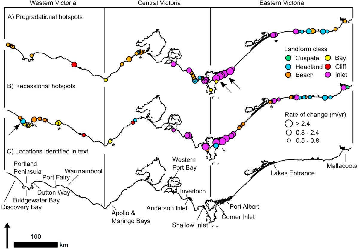
.Teresa Konlechner et al. (2020) use multi-source satellite imagery from #Landsat and #Sentinel2 in #GoogleEarthEngine to estimate trends in regional shoreline position and drivers of change in south-east Australia from 1987 to 2017. #LoLManuscriptMonday bit.ly/TKonlechner_20…
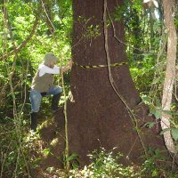
Ladies of Landsat UFV USP UC Santa Barbara CSIRO unicampoficial Thanks Ladies of Landsat! I am really honored to have our paper featured in this #LoLManuscriptMonday ! 😍🌳🛰️🌎🤩


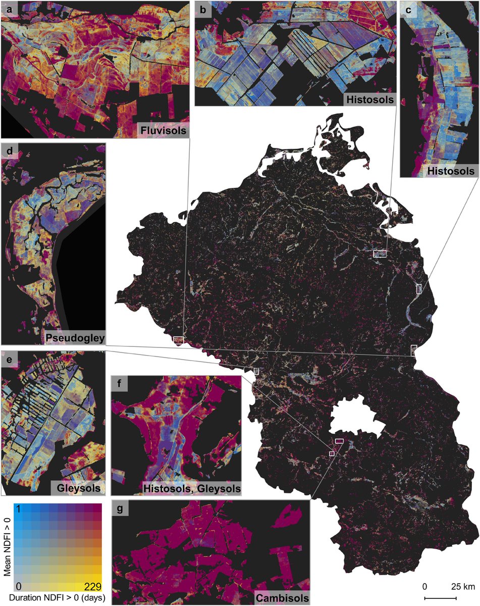
.Katja Kowalski et al. (2022) quantify #drought impacts in a major Central European #grassland region using a regression-based spectral unmixing framework and time series analysis using all #Sentinel2 data from 2017 to 2020. #LoLManuscriptMonday bit.ly/Kowalski_2022
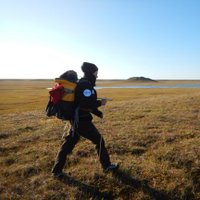
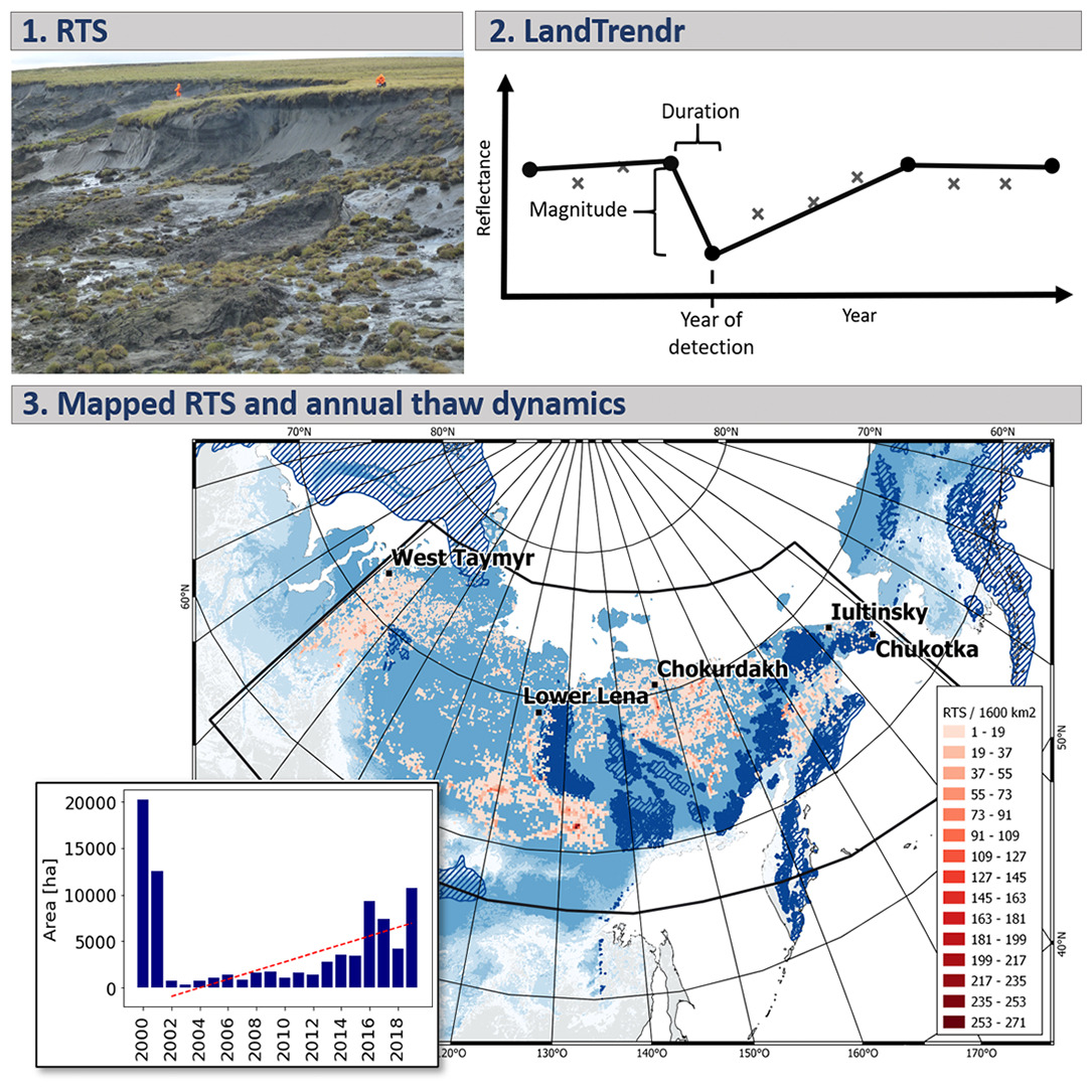
Thank you Ladies of Landsat for featuring my paper on abrupt permafrost disturbances for #LoLManuscriptMonday !

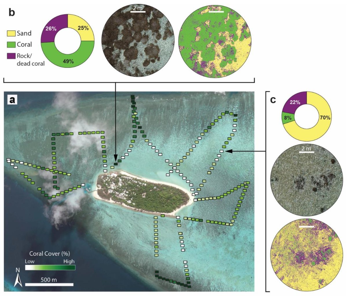
.Katie Bennett et al. (2020) use #RandomForest #machinelearning in #GoogleEarthEngine and #FOSS to classify live coral, sand, and rock/dead coral in 230 #drone #UAV images for Heron Reef, Australia (as part of #SheMaps special issue🎉). #LoLManuscriptMonday bit.ly/Bennett_2020

Adding this to my to-read list! Fine-grain population maps are super useful for global scale urban research #LoLManuscriptMonday
My paper has been featured by Ladies of Landsat for their series #LoLManuscriptMonday . What an honour ☺️ Thank you!
Thanks @LadiesofLandsat for the feature on #LoLManuscriptMonday in 2021! #WomeninRemoteSensing
Quote Tweet

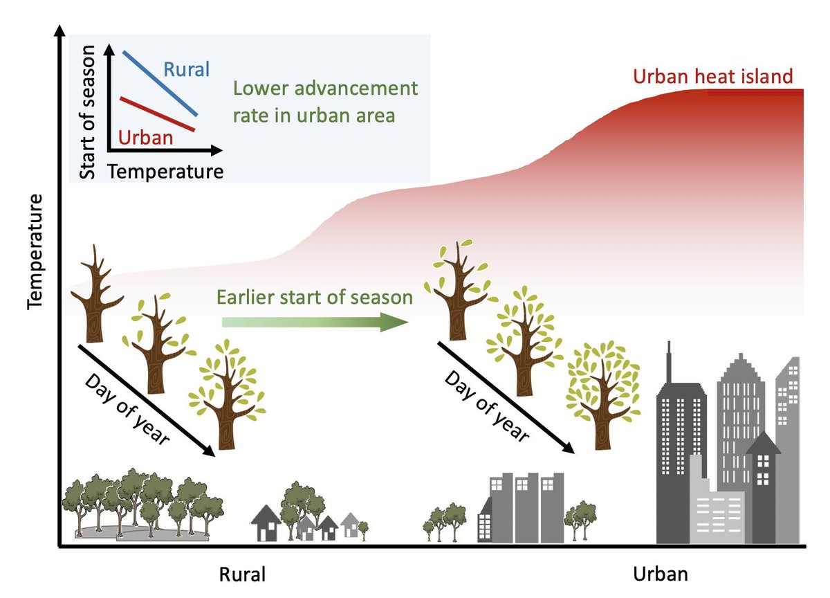
.Dr. Lin Meng et al. (2020) use #MODIS #phenology products and #TopoWx & #Daymet climate data to explore the advancement of spring green-up caused by the urban heat island effect from 2001-2014 in 85 large cities across the USA. #LoLManuscriptMonday bit.ly/Meng_2020

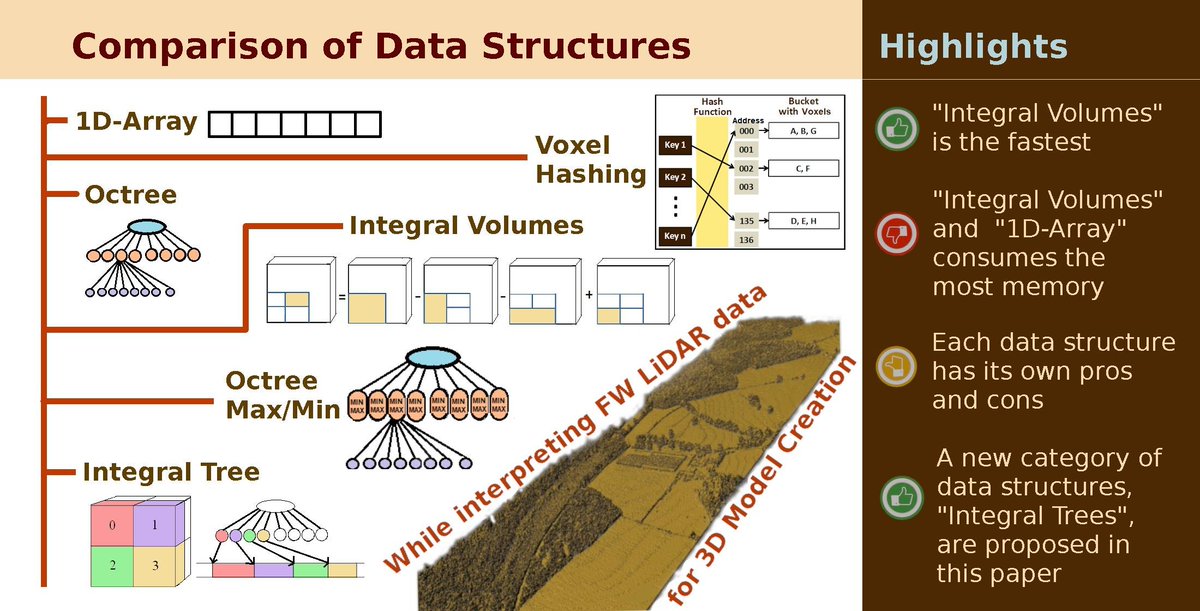
.Milto Miltiadou et al. (2021) compare benefits and downsides of six voxelized full-waveform airborne #LiDAR data structures when creating 3D polygonal models from four #LiDAR flight lines collected by a Leica ALS550-II sensor in the UK. #LoLManuscriptMonday bit.ly/Miltiadou_2021

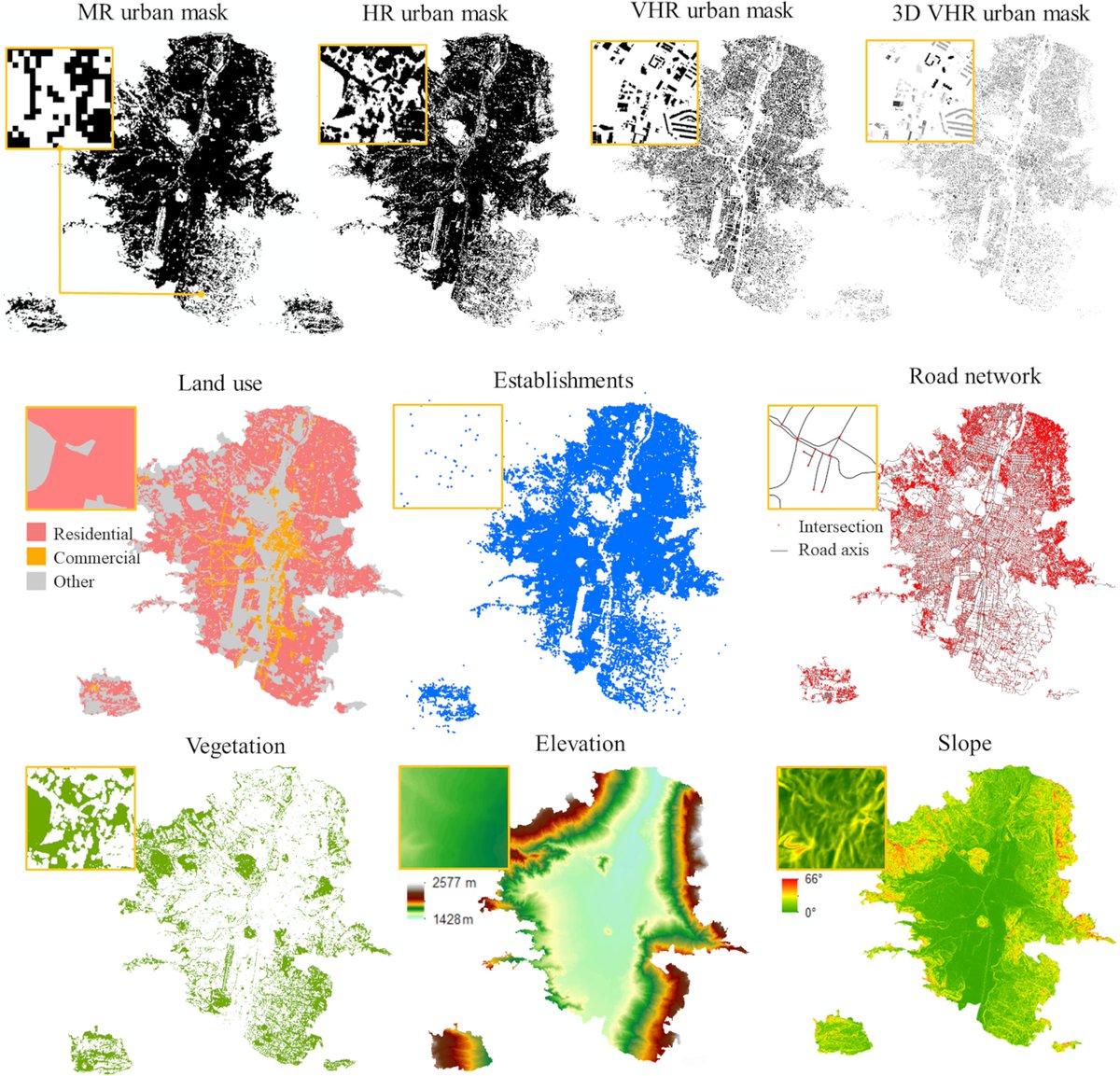
.Marta Sapena et al. (2022) compare several methods for disaggregating population figures from higher-resolution #geospatial and #remotesensing data into fine-grained population maps to recommend the best approach based on input data. #LoLManuscriptMonday bit.ly/Sapena_2022

.Tina Liu 🔥 et al. (2019) apply experimental MODIS-Landsat (ModL2T) methods to map 30m burned areas in #GoogleEarthEngine and refine global fire emission estimates for post-monsoon agricultural fires in northwestern India. #LoLManuscriptMonday bit.ly/Liu_et_al_2019


Feel happy that my recent #paper is acknowledged as a distinct contribution in #RemoteSensing and has been highlighted by
Ladies of Landsat 😁😁
#LiDAR #LoLManuscriptMonday

@[email protected] @BZgeo EOchatBot Another thing on my mind today during #EOChat is planning the next 15+ weeks of #LoLManuscriptMonday !! There are so many spectacular research articles coming out every day from early-career scientists in earth observation. I love this part of organizing Ladies of Landsat! 🥳🛰️📡

Thank you Ladies of Landsat for featuring our #PNAS work on urban #phenology and heat island for this week’s #LoLManuscriptMonday ! 🌲🌱

.Alexandra Runge et al. (2022) apply the #LandTrendr disturbance detection algorithm on combined Landsat & Sentinel-2 mosaics in #GoogleEarthEngine to map & assess abrupt permafrost thaw disturbances at a large scale in North Siberia. #LoLManuscriptMonday bit.ly/Runge_2022

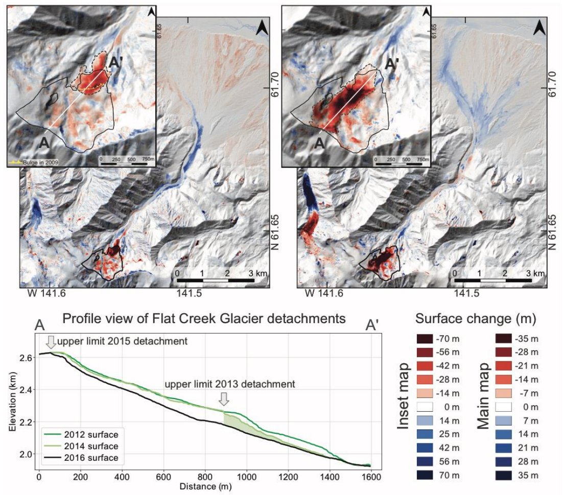
.Mylène Jacquemart et al. (2020) use field data, #PlanetScope imagery and #ArcticDEM data to map and analyze the causes and impacts of two large-scale glacier detachment events in 2013 and 2015 for the Flat Creek Glacier, Alaska, USA. #LoLManuscriptMonday bit.ly/Jacquemart_2020

Very cool that our manuscript was highlighted in Ladies of Landsat weekly series, Manuscript Monday!
#SheMaps #LoLManuscriptMonday
@KEJoyce2
Nicolás Younes 🛰️🔥🌲🌏
James Cook Uni

It is a great honor for me to be featured on #LoLManuscriptMonday in 2021! 💫 #WomeninRemoteSensing 🛰

Delighted to have a recent paper mapping shoreline change from satellite imagery featured by Ladies of Landsat. #LoLManuscriptMonday

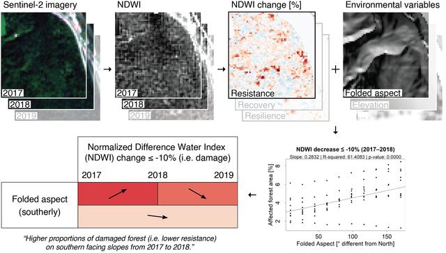
.Joan Sturm et al. (2022) analyze relative change in the Normalized Difference Water Index #NDWI from #Sentinel2 to quantify the response of >1 million forest pixels across Switzerland during the 2018 drought. #LoLManuscriptMonday bit.ly/Sturm_2022

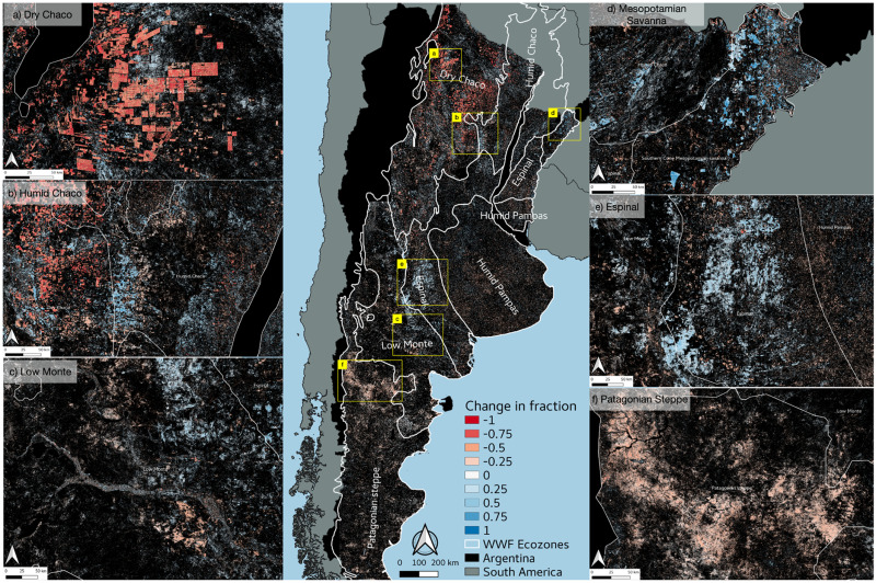
.Dr. Radost Stanimirova et al. (2022) map fractional cover & characterize spatial & temporal #LULC changes in specific vegetation types for two decades in Argentina, Paraguay & Uruguay using #Landsat time-series data & spectral mixture modeling. #LolManuscriptMonday bit.ly/Stanimirova_20…
Really excited to see our latest paper featured in the #LoLManuscriptMonday Ladies of Landsat !

So cool! Our recent pub on using EO for SDG 6.6 reporting is featured by Ladies of Landsat for #LoLManuscriptMonday 🛰🌍❤ Shoutout to the awesome scientists I worked with, including Dr. Lola Fatoyinbo Danielle Wood Dr. Argyro Kavvada David Lagomasino & many more!

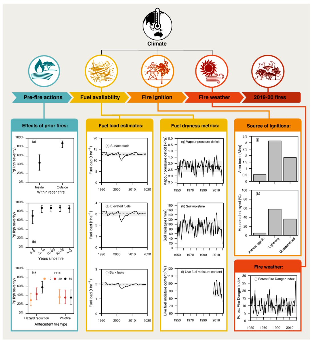
.Rachael Nolan et al. (2021) examine the causes, impacts, & responses of the 2019-20 Australian fire season through a pyrogeographical analysis of #MODIS #Terra live fuel moisture content, #Sentinel2 fire severity & local datasets. #LoLManuscriptMonday bit.ly/Nolan_2021

Cheers to Francesca Giannetti’s co-authors and organizations on this #LoLManuscriptMonday highlight: @gheraiddo, Università di Firenze, @Saverio69588167, & Davide Travaglini 🎉🌲🛰️ #EOChat

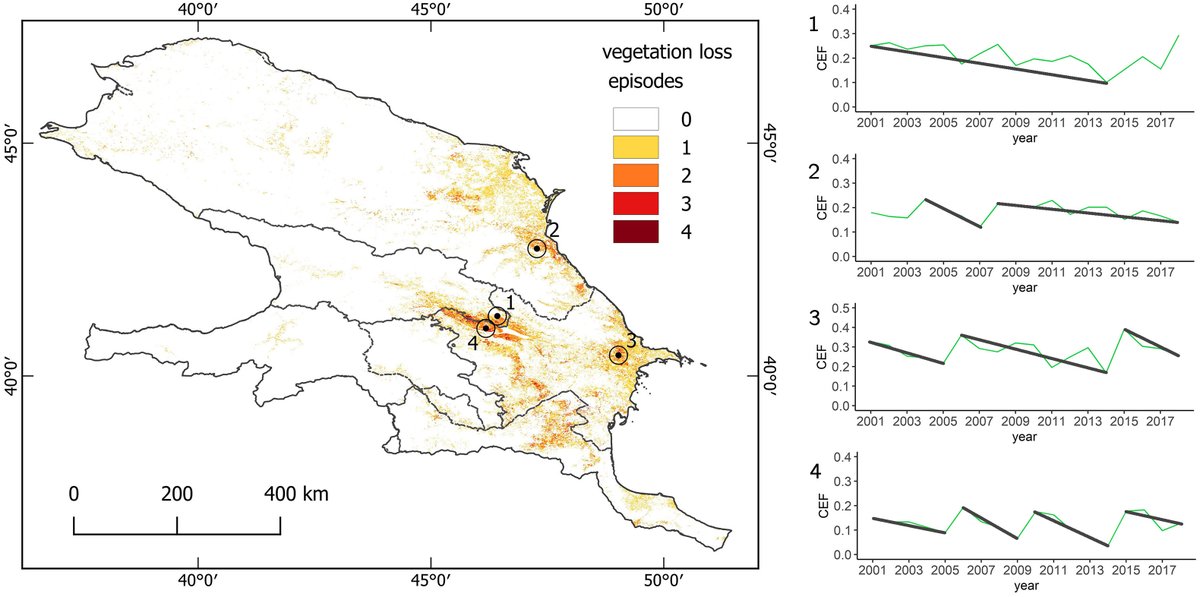
.Katarzyna Ewa Lewińska @[email protected] et al. (2020) present a novel approach using spectral mixture analysis #SMA and #LandTrendr temporal segmentation with #MODIS time-series observations in #GoogleEarthEngine to monitor grassland degradation in the Caucasus. #LoLManuscriptMonday bit.ly/Lewinska_2020
