Circuit(@circuitrobotics) 's Twitter Profile Photo

Drones are being used to revolutionize how we map riverbeds 💡

AltoMaxx Technologies Inc. has developed a drone platform that's changing how we collect bathymetric data. Bathymetry measures the depth beneath water surfaces, producing underwater maps of riverbeds, creek systems,

account_circle
Michael Gevlich(@MichaelGevlich) 's Twitter Profile Photo

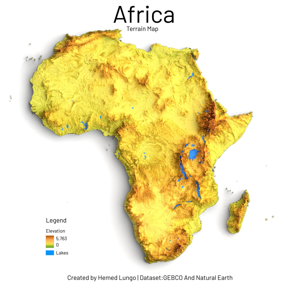
I am pleased to announce that is moving to a new global terrain elevation model. The new terrain is updated from public elevation data sources, some areas may be 1cm - 2m accurate elevation data and also includes global bathymetry data.

account_circle
Laura Szczyrba(@laura_szczyrba) 's Twitter Profile Photo

At ?? Come see my talk Thursday morning at 10:30 am! See how I use radar to detect rip currents and estimate bathymetry!

OT42B-01

At #OSM24 ?? Come see my talk Thursday morning at 10:30 am! See how I use radar to detect rip currents and estimate bathymetry!

OT42B-01
account_circle
Tatiana Pashagina(@viola__alba) 's Twitter Profile Photo

🗺️ Week 7 'Islands'. A model of volcano island made of DEM ⛰️🌋and bathymetry 🌊🌊in Seems good enough for an experiment, I think😊

Looks like a vinyl record cover to me💿🎙️

#MapPromptMonday 🗺️ Week 7 'Islands'. A model of #Stromboli volcano island made of DEM ⛰️🌋and bathymetry 🌊🌊in #Blender Seems good enough for an experiment, I think😊

Looks like a vinyl record cover to me💿🎙️

#QGIS #gis #b3d #3dviz
account_circle
Irfan Rashid(@irfansalroo) 's Twitter Profile Photo

Gearing up for the intense summer field campaign for of glacial lakes in the western Himalaya, we tested our CHC Navigation robotic echosounding boat in the deepest valley lake of Kashmir, the Manasbal as part of MoES GoI project on risk +

account_circle
Python Maps(@PythonMaps) 's Twitter Profile Photo

Bathymetry of the Mediterranean. I used the ocean colourmap and I think the colours come together really beautifully.

Bathymetry of the Mediterranean. I used the ocean colourmap and I think the colours come together really beautifully.
account_circle
Manolito Caldas(@DADDYJOSE) 's Twitter Profile Photo

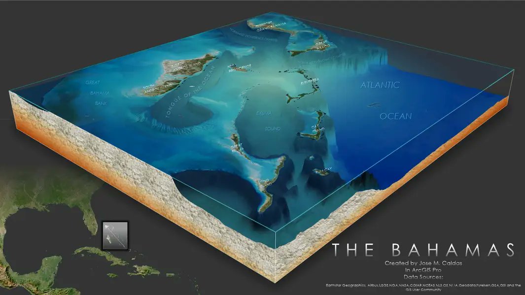
I've been making a series of maps of my ship's port visits during the early '80s using John Nelson Imhof-like style, but the Bahamas called for a 3D diorama map using Living Atlas's Topobathy. Flat islands, awesome bathymetry.

I've been making a series of maps of my ship's port visits during the early '80s using @John_M_Nelson Imhof-like style, but the Bahamas called for a 3D diorama map using Living Atlas's Topobathy. Flat islands, awesome bathymetry. 
#arcgispro
account_circle
Jim Pullen(@JimPullen9) 's Twitter Profile Photo

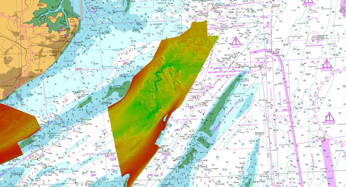
Wonderful high-resolution bathymetry from the Hydrographic Office showing the bottom end of the Swin. Scattered with ship wrecks, possible ice wedges?? and a drowned river channel.

Wonderful high-resolution bathymetry from the Hydrographic Office showing the bottom end of the Swin. Scattered with ship wrecks, possible ice wedges?? and a drowned river channel.
account_circle
Hope Nyabienda(@HopeNTeach) 's Twitter Profile Photo

Biggest update to my learning occurred in Alistair Hamill Plate Tectonics theory update… he knew how to speak my language and wow- the new understanding of tectonics is so cool!! Brook Mead Geography did you know that the true genius behind bathymetry was a WOMAN! 💪

Biggest update to my learning occurred in @lcgeography Plate Tectonics theory update… he knew how to speak my language and wow- the new understanding of tectonics is so cool!! @BMA_Geography did you know that the true genius behind bathymetry was a WOMAN! 💪 #GAConf24
account_circle
UF Gator Glaciology(@GatorGlaciology) 's Twitter Profile Photo

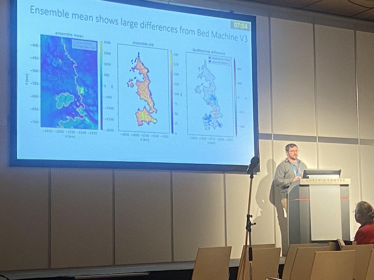
PhD student Michael Field at his invited EGU talk! Geostatistical gravity inversions provide new details on the bathymetry beneath Amundsen Sea ice shelves

PhD student Michael Field at his invited EGU talk! Geostatistical gravity inversions provide new details on the bathymetry beneath Amundsen Sea ice shelves
account_circle